
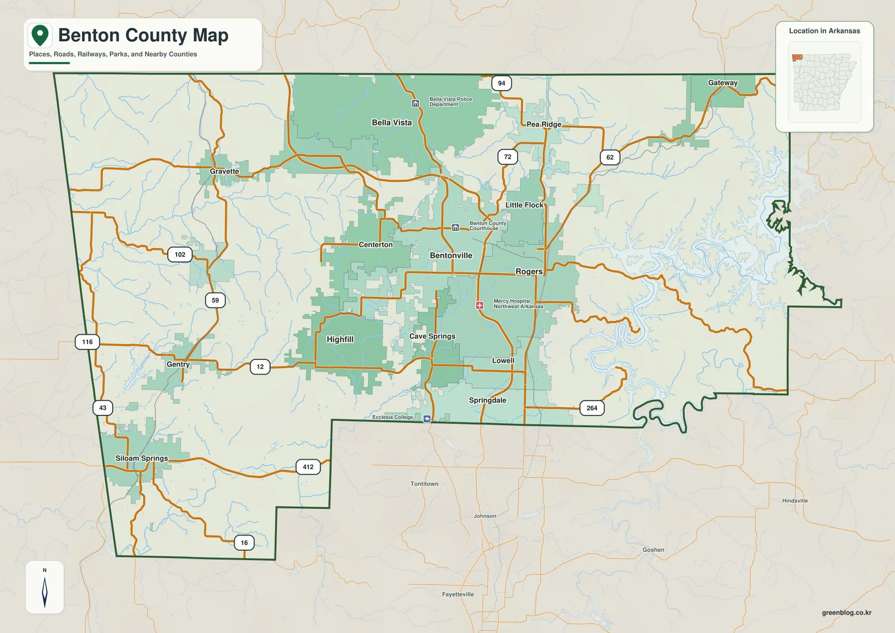
Benton County in northwest Arkansas presents a striking geographical duality, shifting from densely packed urban centers in the north to expansive river valleys and higher ridges in the east. Understanding this landscape requires looking beyond a single view to appreciate how roads, waterways, and elevation define the region's unique character.
A Dual-Landscape Geography
The county's visual identity splits dramatically between its northern and eastern regions. Around Bentonville and Rogers, cities and roads crowd together, creating a bustling core where communities like Bella Vista, Pea Ridge, and Centerton fill the central space. In contrast, moving east reveals a landscape dominated by the branching outline of Beaver Reservoir, the White River, narrow valleys, and higher ridges. The western side places distinct communities such as Siloam Springs, Gentry, Gravette, and Centerton farther apart among long creeks and lower terrain. This transition is best understood by comparing multiple map layers rather than relying on one image.
Navigating Roads, Water, and Elevation
To truly grasp the county's layout, one must examine how different features interact across specific views. The overview establishes the boundary and road network, showing major routes like Route 94 near Bella Vista, Route 72 toward Pea Ridge, and Route 62 crossing the east side near Rogers. Other significant paths include Routes 59 and 102 around Gravette, Route 12 through Gentry, and Route 412 providing a strong reference for Siloam Springs. The water map reveals critical features like Beaver Reservoir, Little Sugar Creek, the Illinois River, and smaller tributaries often missed on standard overviews. Finally, the elevation data reports an actual county range of about 263 to 551 meters, illustrating how lower western valleys give way to more strongly dissected terrain in the east.


0 댓글