
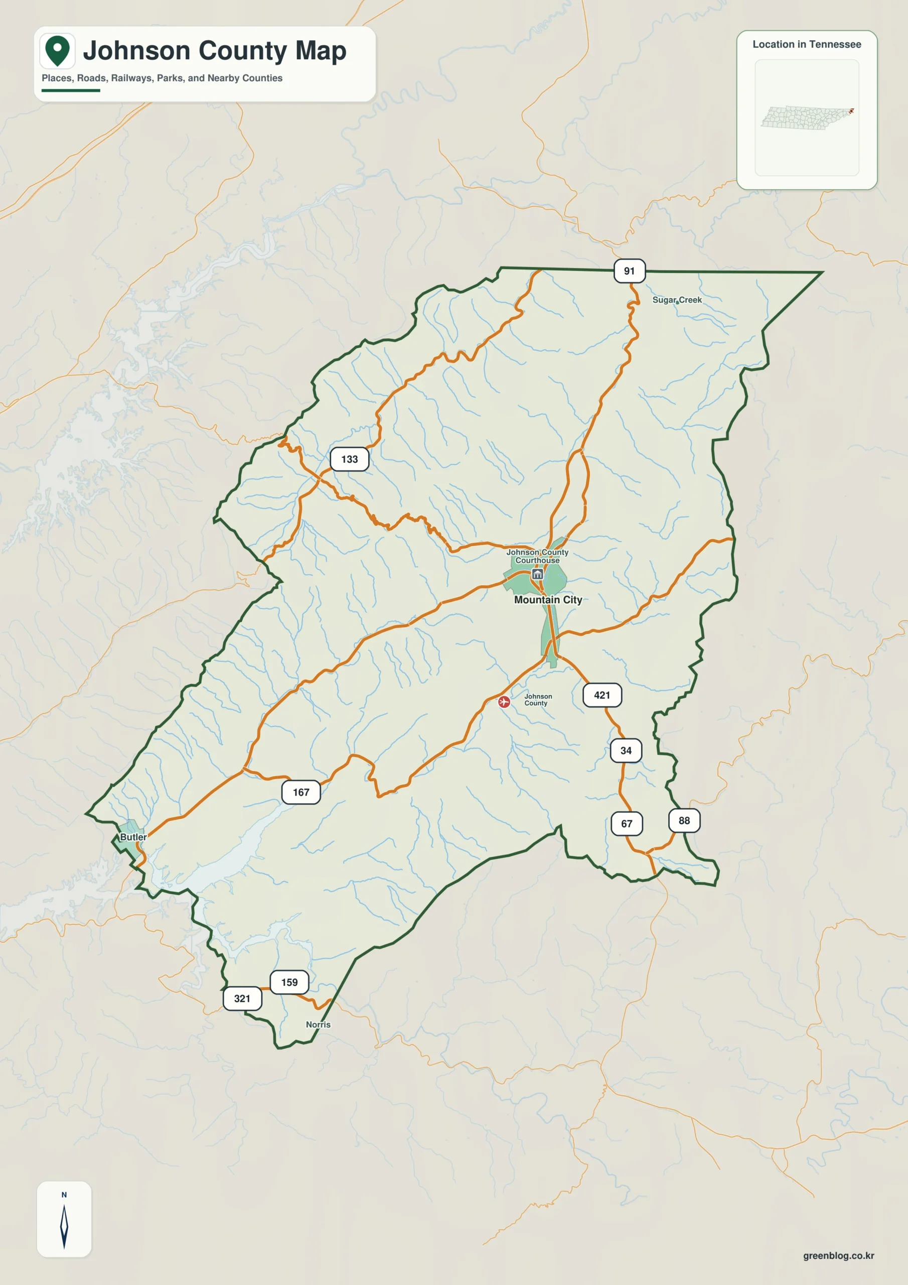
Johnson County in northeastern Tennessee is defined by dramatic relief rather than flat roads. With an elevation range spanning from 595 meters to 1,664 meters, the landscape features narrow valleys and long mountain ridges that separate what appears close on a map into substantial distances in reality.
Mountain City as the Primary Reference Point
Mountain City serves as the sole ranked settlement and county seat, acting as the central anchor for understanding the region. Situated slightly east of the county's center near the courthouse, it connects three distinct mountain directions through key routes like 421 and 91. While Butler appears toward the Watauga Lake side and Norris marks the southern extension, Mountain City remains the only major city with a population rank listed at 2,542 residents. Surrounding this hub are smaller references such as Sugar Creek in the north and Carter County to the west, providing orientation without cluttering the map with dense community data.
Roads and Waterways Shaped by Relief
The transportation network follows the natural topography, avoiding a broad grid in favor of winding paths through mountain gaps. Routes 421 and 91 form the primary corridor near Mountain City, while Route 34 extends southeast. Further south and east, Routes 67, 88, 321, and 159 navigate the terrain toward Norris, and western anchors include Routes 167 and 133 connecting to Butler. Water features dominate the landscape, with Watauga Lake occupying the southwestern side near Butler. Inland, numerous creeks like Beaverdam Creek, Roan Creek, and Furnace Creek cut deep passages through the interior, creating a complex system of drainage that divides the high ridges rising across the north, east, and southeast.
Download the high-resolution A3 JPG ZIP for this Johnson County Tennessee Map


0 댓글