
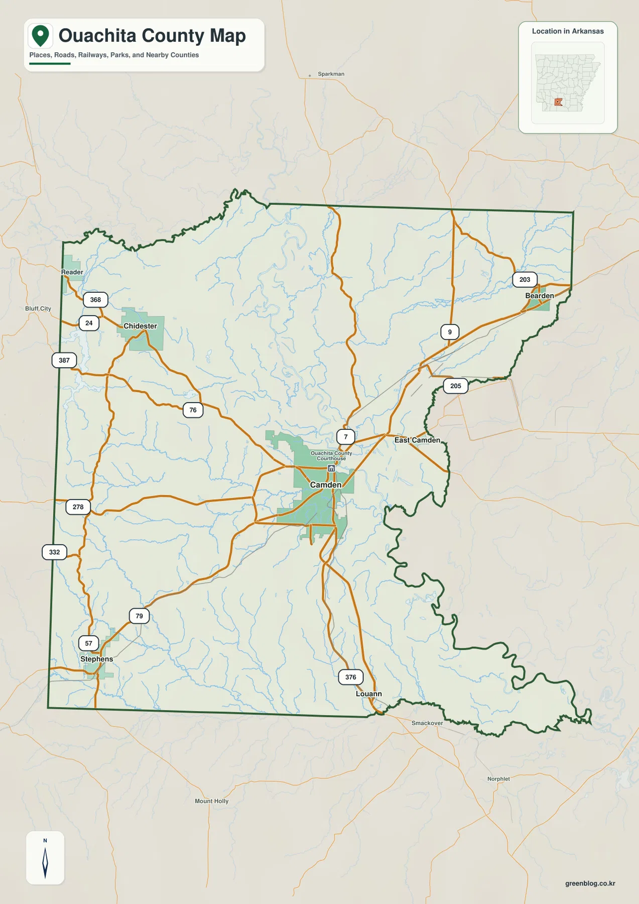
Located in south-central Arkansas, Ouachita County is defined by its unique geography centered on the city of Camden. Situated at a horseshoe curve of the Ouachita River, this county seat offers a distinct vantage point overlooking broad river bends and the surrounding landscape that transitions from low plains to significant elevation changes.
Geographic Layout and Elevation Variations
The terrain of Ouachita County presents a dramatic contrast between the rolling western hills and the flat river plain near Camden. The elevation map reveals heights ranging from approximately 23 meters in the lowlands to 124 meters in the west, with an average of 56 meters across the county. Major communities such as Chidester to the west, Bearden to the east, Stephens to the southwest, and Louann to the south are situated within these varied settings. The Little Missouri River marks the northern boundary, while Clark, Dallas, Calhoun, Union, Columbia, and Nevada counties surround the region. The general map highlights Route 7 running north-south through the center, connecting East Camden with the western interior via Routes 9, 205, and 76.
Urban Hierarchy and Water Features
Camden serves as the primary urban hub, ranking first among six major communities identified on the ranked city map. The hierarchy places Stephens second, followed closely by East Camden, with Bearden, Chidester, and Louann occupying positions four through six respectively. Beyond the road network, the water features play a critical role in defining the landscape. The Ouachita River creates complex low country east of Camden, featuring bends and old channels like Toney Old River and Lower Old River. To the east, Bearden sits near the Freeo Creek valley, while Stephens lies in the southwestern region. The interplay between the river's horseshoe curve and the scattered rural communities creates a distinct pattern across the county.


0 댓글