
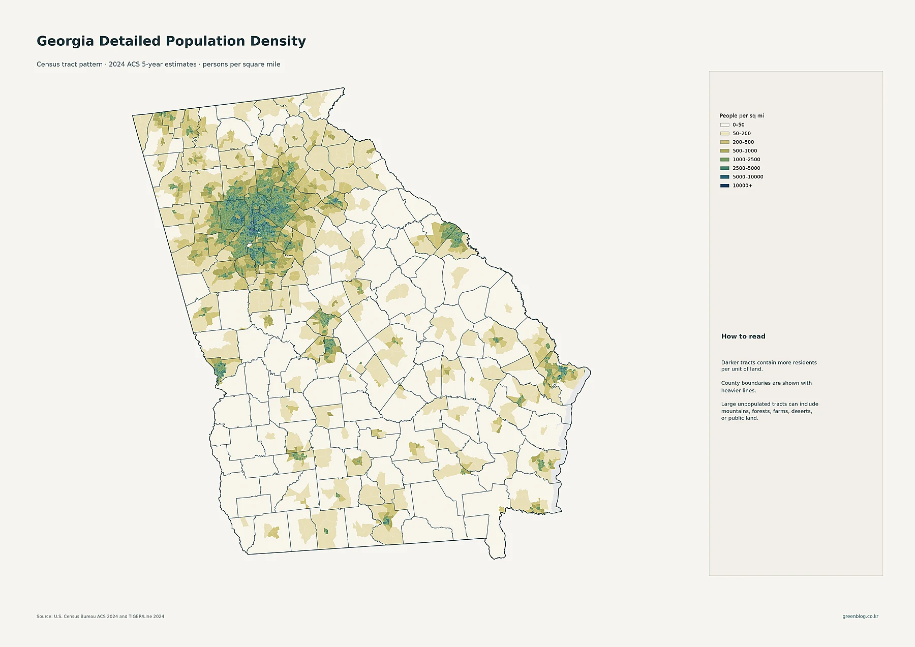
Georgia's demographic story is defined by a massive concentration around Atlanta, yet it features distinct urban networks in Augusta, Savannah, Columbus, Macon, and Athens. Understanding the state requires separating total population counts from land density and historical growth rates.
Distinguishing Population Size from Density and Growth
While Fulton County holds the largest 2024 population at 1,076,561 residents, DeKalb County actually possesses the highest density with approximately 2,859 people per square mile. This distinction highlights that a large total count does not equate to high crowding, as Fulton covers a vast area. Furthermore, growth rates tell a different narrative; Bryan County experienced the fastest percentage increase from 2010 to 2020 at +48.0%, whereas Dooly County saw the largest decline of -24.9%. These metrics are essential for accurate analysis because a county can be populous but spread out, or small yet rapidly expanding.
Tract-Level Details and Major Urban Centers
The detailed tract map reveals a broad high-density footprint stretching across multiple county boundaries in north-central Georgia, rather than stopping at city limits. Census tracts show density ranges from 0–50 people per square mile up to 10,000 or more, with the darkest clusters indicating the most intense residential areas. Beyond Atlanta, smaller dense pockets appear around Augusta, Savannah, Columbus, Macon, and Athens. Major cities are further visualized by circle size representing 2024 census-place populations, with Atlanta leading at 505,268 residents, followed by Columbus at 203,711 and Augusta-Richmond County at 101,528.


0 댓글