
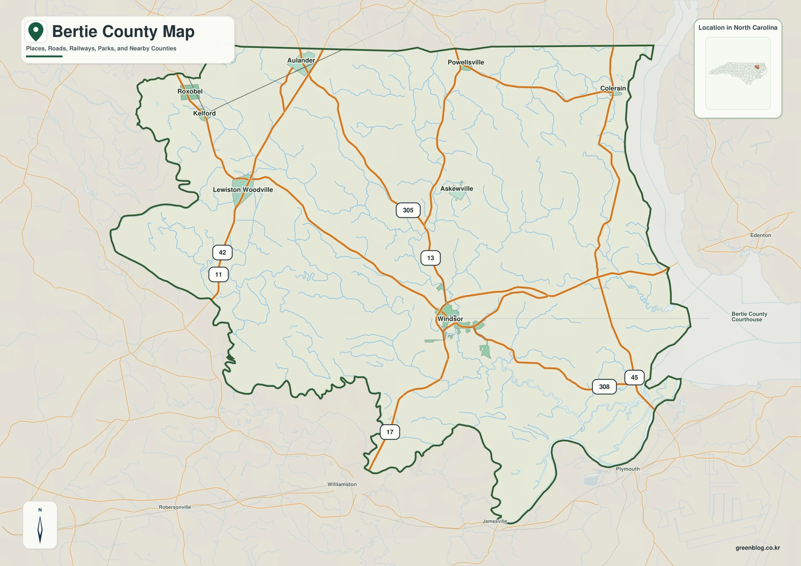
Bertie County in northeastern North Carolina is defined more by its flat waterways than its rolling hills, with Windsor serving as the central hub connecting a network of small towns along major highways.
Road Corridors and Town Distribution
The county's geography relies heavily on specific highway routes that organize its scattered communities. US 13 and US 17 form the primary north-south spine, linking Windsor to northern towns like Aulander and Powellsville. In contrast, the western side of the county follows a different network centered on NC 11 and NC 42, which serve Lewiston-Woodville, Roxobel, and Kelford. Travelers moving toward Colerain in the northeast should utilize NC 45 and NC 308, while NC 305 traverses the central-northern region near Askewville. Because the terrain is low relief, road mileage often feels longer than it appears on a standard map scale, making these specific routes essential for general direction rather than precise travel time estimation.
Waterways and Settlement Context
Beyond the paved roads, the Cashie River acts as a critical geographic anchor, tying Windsor to the lower Roanoke drainage system. To the east, the Chowan River and Albemarle Sound define the county's water boundary, while an intricate web of swamps and creeks like Salmon Creek creates significant lowland structure. The settlement index highlights six key towns—Windsor, Aulander, Lewiston-Woodville, Roxobel, Powellsville, and Colerain—but these are rural communities rather than legally incorporated cities. Official coastal land-use materials classify them as towns, with Windsor standing out as the sole county seat situated near the Cashie River.


0 댓글