
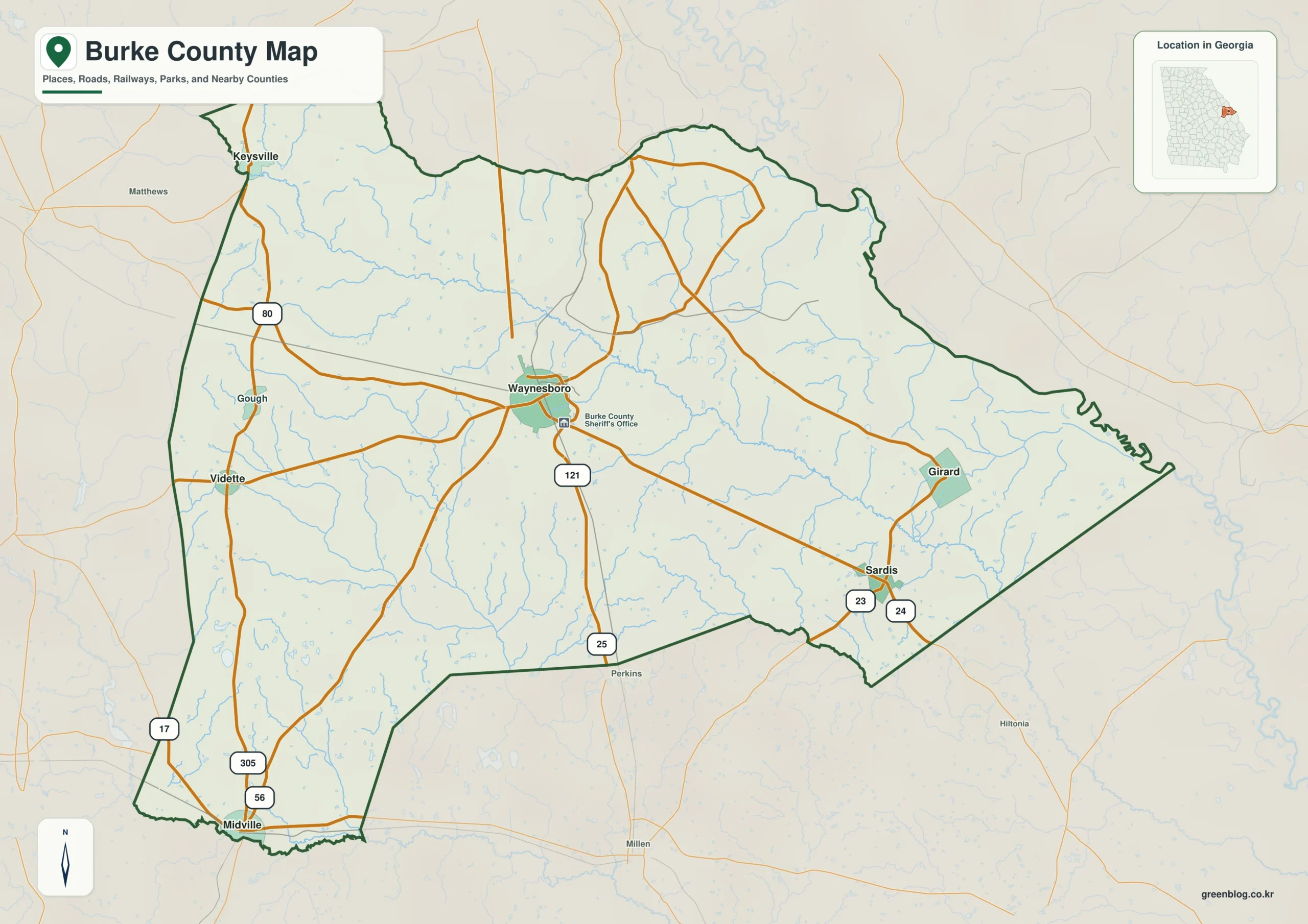
Burke County in eastern Georgia offers a diverse landscape defined by its central hub of Waynesboro, surrounded by six key communities and crisscrossed by significant water systems. Understanding the county's geography requires looking beyond simple boundaries to examine how roads connect rural areas, how creeks shape the terrain, and how elevation varies from the western highlands to the eastern Savannah River edge.
Navigating Communities and Road Networks
The county's layout is best understood through its road network centered on Waynesboro, which serves as a central hub connecting six distinct communities: Keysville to the northwest, Vidette and Midville to the west and southwest, Sardis to the southeast, and Girard to the east. These locations are not merely suburbs but represent a spread across a large rural area where long road connections traverse farmland and creek valleys. While specific routes such as 25, 80, 121, and 305 link these towns, the county's boundaries often bend around drainage features rather than forming simple rectangles. It is important to note that this map serves for regional orientation only; it does not define legal property lines or municipal limits, and other incorporated places like Blythe exist outside the six labeled communities.
Water Systems and Topographical Variation
Beyond the road system, Burke County is defined by a complex network of waterways, with Brier Creek being the most prominent feature that runs diagonally across the county from northwest to east. This creek system includes numerous tributaries like Beaverdam Creek and Rocky Creek in the west, alongside smaller features such as Buckhead Creek and Bark Camp Creek further south. The Ogeechee River marks the southwestern edge, while various ponds including Timmons Pond, Gordon Pond, and Brinson Millpond dot the landscape. Topographically, the county rises from a low of approximately 22 meters to a high of 143 meters, with the western and northwestern areas generally higher than the green, lower corridors found along major creek valleys near the eastern side.


0 댓글