
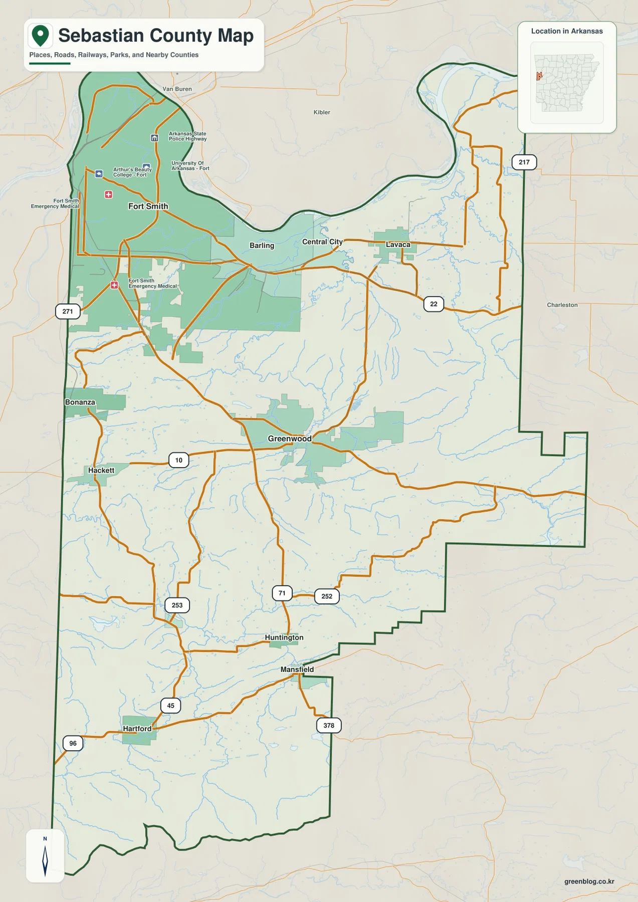
Sebastian County presents a dramatic geographic shift within Arkansas, transitioning from the bustling riverbanks of Fort Smith near the Oklahoma border to the rugged ridges and valleys of the southern interior anchored by Greenwood.
Dual County Seats and Geographic Contrast
Unlike many counties with a single administrative center, Sebastian County operates with two distinct county seats: Fort Smith in the northwest and Greenwood in the south. This unique arrangement stems from a historical decision in 1861 to divide the county into two judicial districts, allowing both cities to maintain their courthouse functions. The geography reinforces this duality; Fort Smith serves as the hub for the dense urban area defined by the Arkansas River's northern bend, while Greenwood acts as the central reference point for the road networks and communities stretching across the southern half. Settlement density drops significantly south of Greenwood, where towns like Huntington, Mansfield, and Hartford exist within large rural gaps amidst strongly ridged terrain.
Mapping Terrain, Waterways, and Urban Centers
Understanding Sebastian County requires comparing multiple map perspectives to capture its full complexity. The reference map is essential for verifying boundaries, as the county's irregular shape features large bends along the Arkansas River and complex edges meeting neighboring counties. For urban analysis, a ranked city-distribution map highlights Fort Smith as the dominant settlement, followed by Greenwood, Barling, and Lavaca in the north, while excluding smaller communities like Hackett and Bonanza from its primary labels. Conversely, terrain and elevation maps reveal how the landscape climbs from the northern river corridor into the southern ridge country, explaining why the land around Greenwood differs so much from Fort Smith's setting. Smaller streams follow interior valleys, creating a waterway pattern that complements the road network visible in the reference view.


0 댓글