
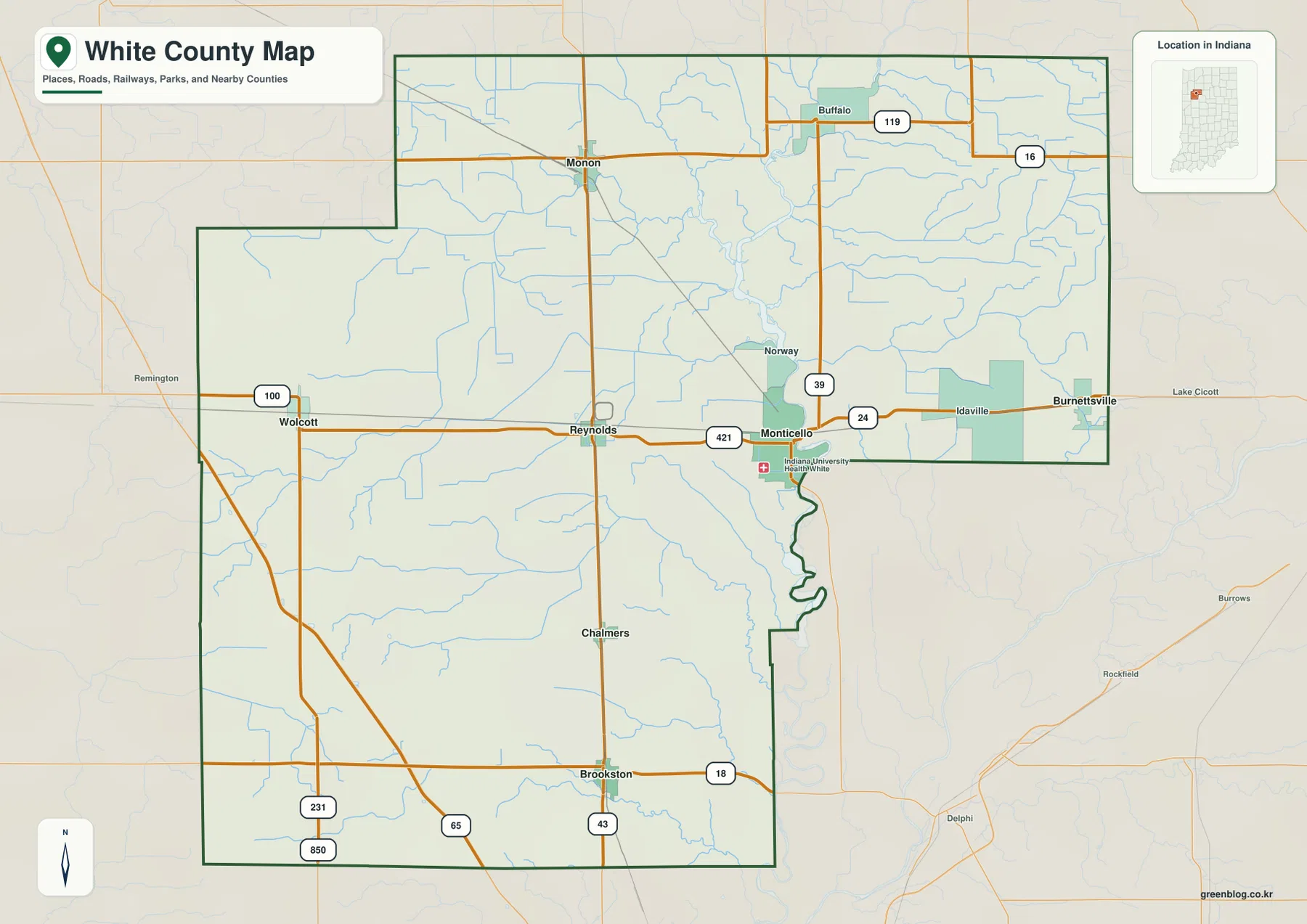
White County in northwestern Indiana is defined by its vast rural spaces and the significant Tippecanoe River system. Understanding the area requires looking beyond simple town names to recognize how major highways like U.S. 24 and U.S. 421 connect communities such as Monticello, Monon, and Brookston across wide stretches of open land.
Understanding the Road Network and County Boundaries
Monticello serves as the essential anchor for orienting oneself within White County, situated near the junction of U.S. 24 and U.S. 421. From this central point, travelers can trace the county's complex road layout, noting how State Road 43 and I-65 traverse the southern regions while U.S. 231 runs through the west. The county's irregular outline, particularly the inward step on the northwest side and the river-following boundary south of Monticello, creates unique challenges for route planning compared to standard rectangular counties.
Settlement Patterns and Topographical Features
The geography of White County is characterized by distinct communities separated by farmland rather than continuous urban development. Key settlements include Monon in the north, Wolcott and Reynolds framing the west, and Chalmers near Brookston in the south. The landscape features dramatic elevation changes where the river corridors sit at lower levels compared to the higher ground in the western sections. Notable water bodies like Lake Shafer and Lake Freeman provide a distinctive setting for Monticello, while the Tippecanoe River remains the strongest water corridor defining the region's natural character.
Download high-resolution JPG files of all four maps in one ZIP archive


0 댓글