
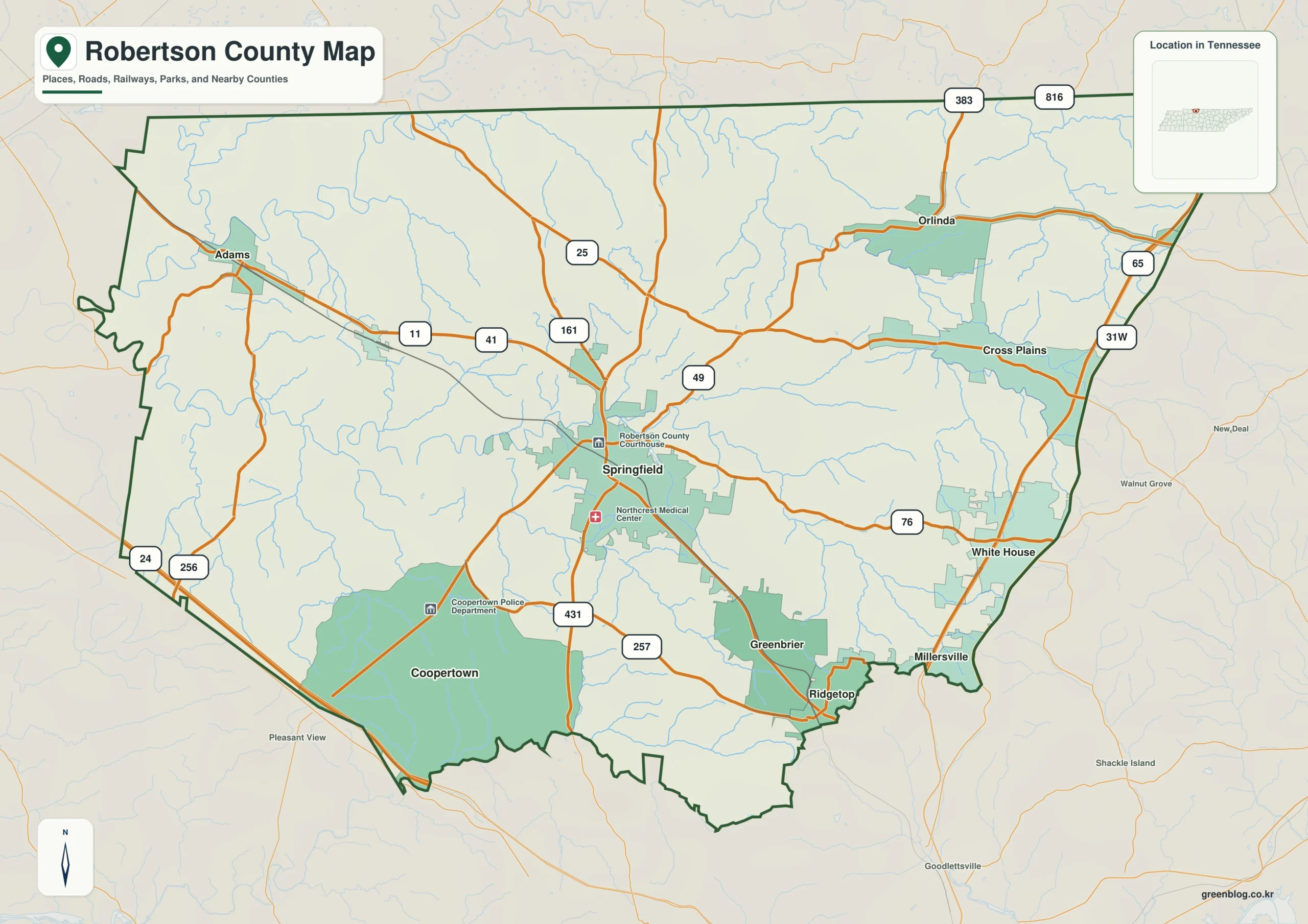
Robertson County sits along Tennessee's northern border with Kentucky, featuring a landscape that rises from lower western valleys toward rolling southeast hills. The area is defined by major waterways like the Red River and distinct population centers such as Springfield and White House.
Geography and Urban Layout
The county's geography is shaped by drainage patterns, with the Red River, Sulphur Fork, and spring-fed creeks defining the western half. Elevation increases from approximately 99 meters in the west to 282 meters toward the southeast. Springfield serves as the primary interior reference point, while White House, Greenbrier, Coopertown, Ridgetop, and Cross Plains illustrate how population centers spread toward the county's edges. A significant feature is the separation between the administrative center and major highway corridors; while Springfield anchors the interior, I-65 and US 31W run near White House and Cross Plains on the eastern side. This creates a distinct travel dynamic where the strongest north-south route does not pass through the county seat.
Population Centers and Regional Context
Six major cities are ranked by population, with Springfield leading at 19,255 residents, followed by White House at 14,631. The remaining towns—Greenbrier (6,971), Coopertown (4,640), Ridgetop (1,995), and Cross Plains (1,922)—form a split pattern between the interior and the county edges. South of Springfield, Greenbrier, Ridgetop, and Coopertown occupy different parts of the county rather than a continuous line, creating several connected local centers near US 41 and SR 257. The outer context includes neighboring Kentucky counties like Logan and Simpson to the northwest, while Tennessee counties such as Sumner and Davidson surround other sides. Understanding these boundaries is essential for locating communities that may extend beyond a single county outline.


0 댓글