
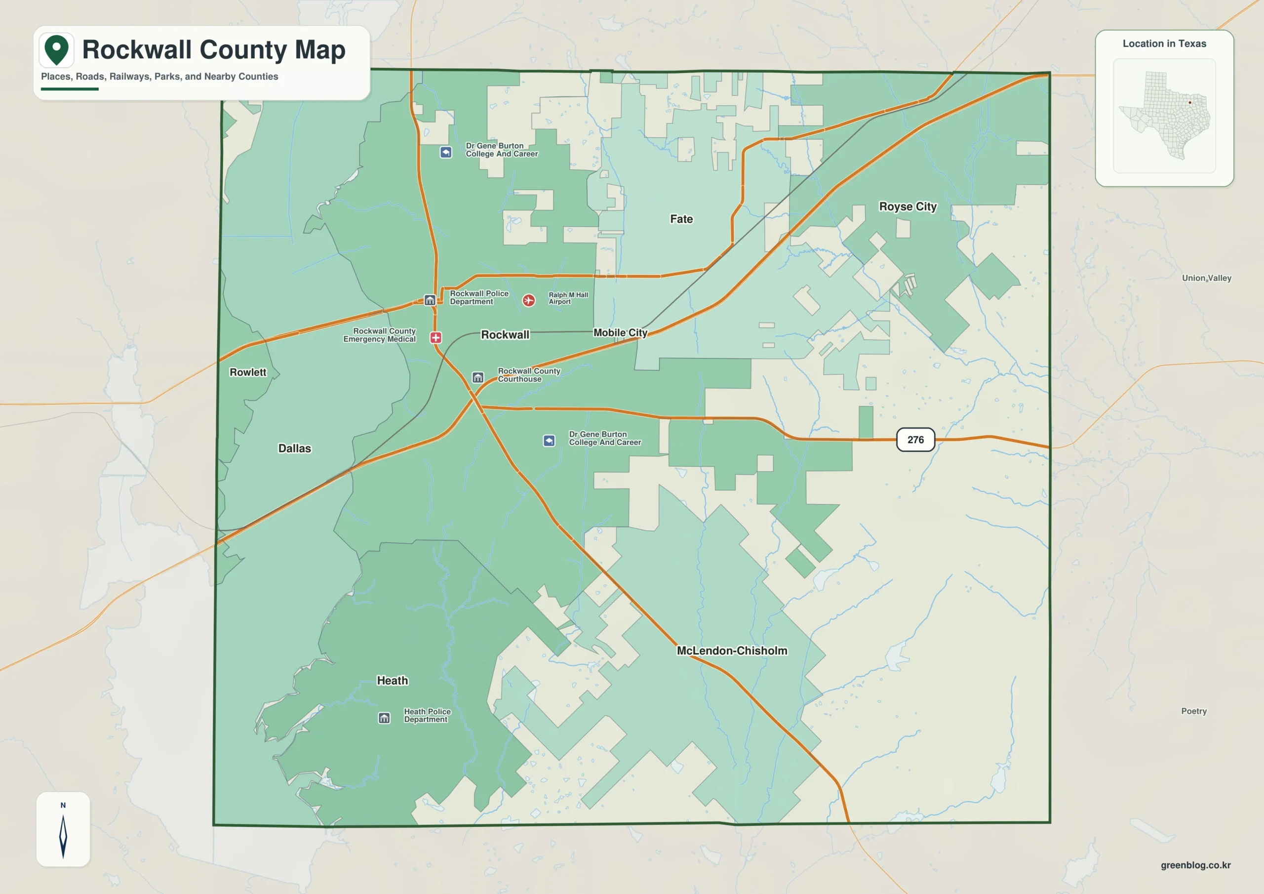
Rockwall County in Texas is best understood by viewing it as a landscape anchored by Lake Ray Hubbard on the west and the corridor of communities along Interstate 30. This region features a distinct north-heavy settlement pattern separated from the southern interior by varying terrain and waterways.
Settlement Patterns and Key Communities
The county's urban fabric is defined by six mapped cities, with Rockwall serving as the primary western anchor near the county courthouse. To the northeast lie Fate and Royse City, while Heath sits southwest near the lake and McLendon-Chisholm occupies the southern interior. The population data highlights Rockwall's dominance with 51,168 residents, followed by Fate (22,884) and Royse City (20,037). Smaller communities like Heath (10,077), McLendon-Chisholm (4,511), and Mobile City (296) complete the picture. This arrangement creates a clear distinction between the northern cluster of towns and the more isolated southern areas.
Terrain, Waterways, and Elevation
Geographically, Lake Ray Hubbard dominates the western side, intersected by Brushy Creek, Hackberry Creek, Parker Creek, and Sabine Creek. The elevation profile reveals a dramatic shift from the low western lakeshore to the ridged interior, ranging between 131 and 190 meters with a mean of 158 meters. Interstate 30 and State Highway 276 provide essential east-west references for navigation. Understanding these layers together clarifies the contrast between the flat lake region and the elevated terrain found in McLendon-Chisholm.


0 댓글