
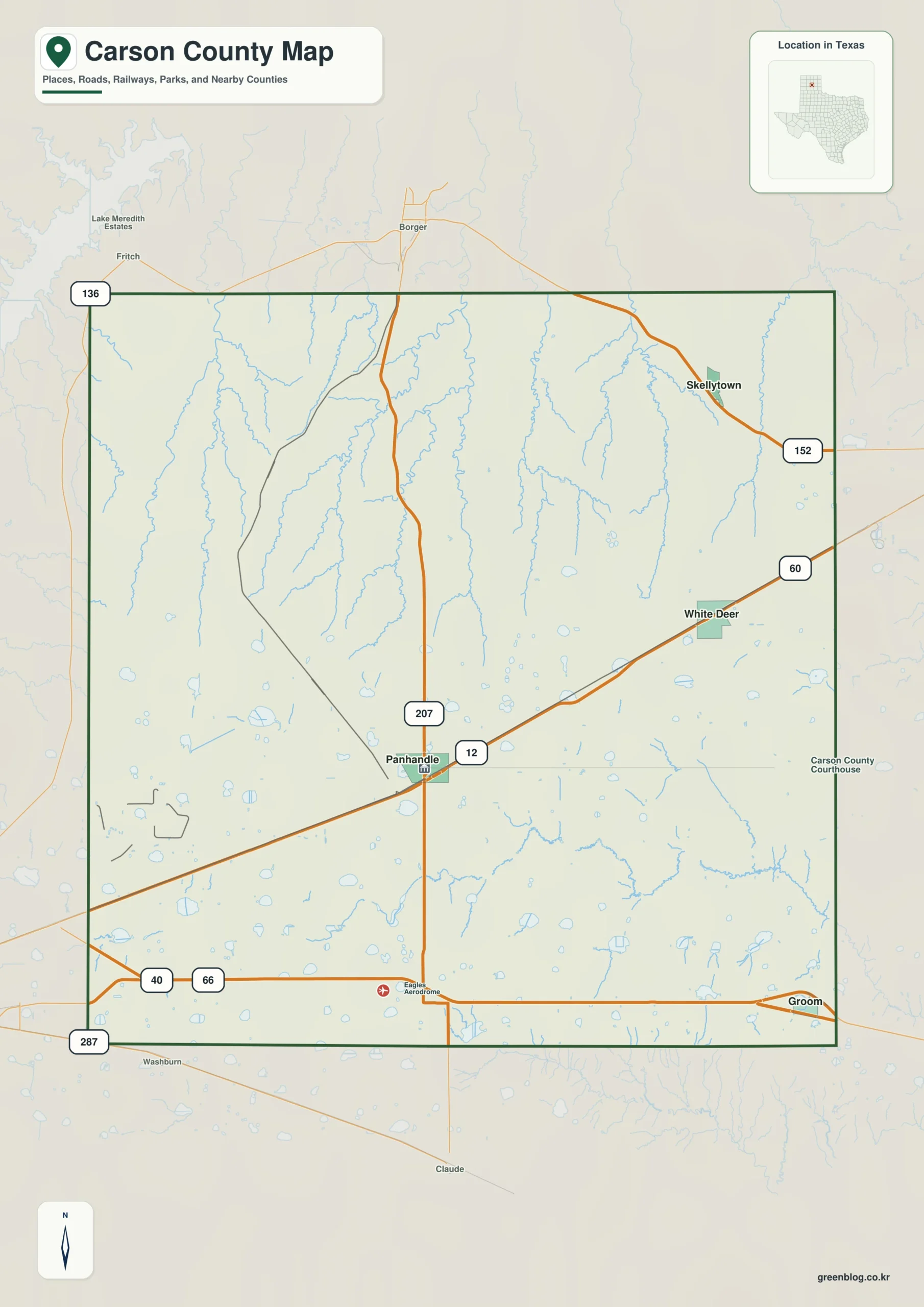
Carson County offers a distinct landscape where open high plains meet intricate drainage systems. Situated in the central Texas Panhandle, this region is defined by major highways crossing vast rural spaces and significant elevation changes ranging from 887 to 1,097 meters.
Road Networks and Urban Layout
The county's transportation infrastructure radiates outward from Panhandle, the central hub where Texas State Highway 207 and US 60 intersect. From this vantage point, travelers can access White Deer to the east via US 60, while Highway 207 extends south toward Interstate 40 near Groom in the southeast. Skellytown lies further northeast, accessible via Highway 152. The map highlights how different highways frame the county's boundaries, with Interstate 40 running through the southern section and Route 66 marking a historic path near Groom. Neighboring counties such as Hutchinson to the north and Donley to the southeast provide additional context for regional travel.
Waterways and Topographical Relief
While road maps suggest a nearly flat terrain, the water map reveals a complex network of Antelope Creek, Dixon Creek, Bear Creek, White Deer Creek, and McClellan Creek dissecting the northern landscape. This drainage pattern creates a stark contrast with the straighter corridors found near Interstate 40 in the south. The elevation data confirms these topographical differences, showing that Carson County spans an average height of approximately 1,025 meters. The variation between the lowest point at 887 meters and the highest at 1,097 meters explains why the northern half appears more deeply etched by waterways compared to the southwestern plain.


0 댓글