
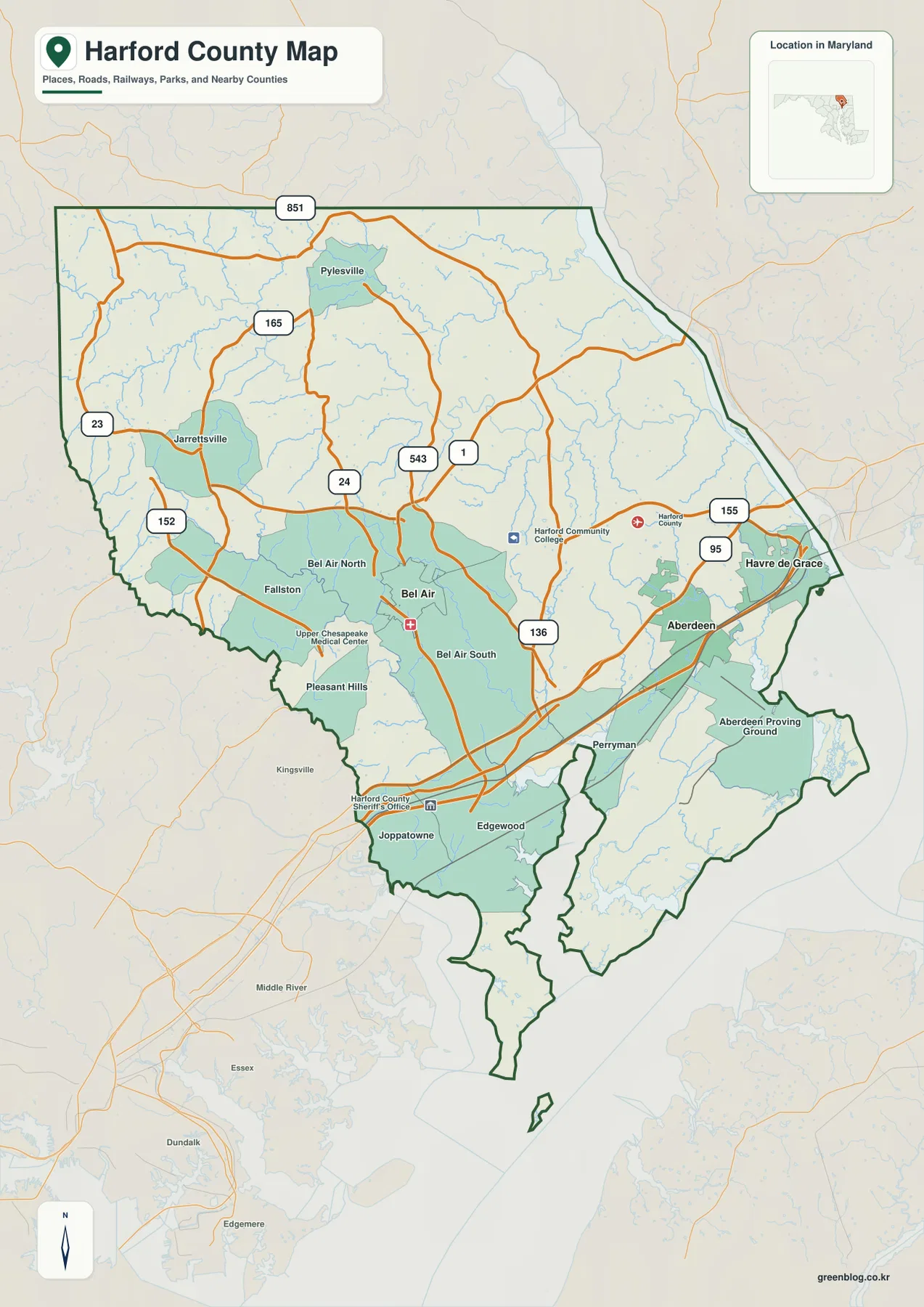
Harford County in Maryland represents a dramatic geographical shift, transitioning from rolling inland uplands in the northwest to the low tidal shores of the Susquehanna and Chesapeake Bay. This unique landscape is anchored by three incorporated municipalities—Bel Air, Aberdeen, and Havre de Grace—which serve as the primary reference points for understanding the county's diverse terrain and road networks.
Geographical Diversity and Municipal Hubs
The county's geography is defined by a clear elevation gradient that falls from the northwestern countryside toward the eastern lowlands. Bel Air acts as the central reference point, situated between the northern communities of Fallston, Jarrettsville, and Pylesville, and the southeastern corridor dominated by Aberdeen and Havre de Grace. While these three cities are the only incorporated municipalities identified by Harford County Government, they exist within a broader settlement picture that includes unincorporated areas like Edgewood, Joppatowne, and Perryman along the southern waterfront. The northern side of the county features stream-cut hills and fewer dense settlements, whereas the south is characterized by large bodies of water, the Susquehanna River mouth, and a strong coastal influence that shapes local geography.
Road Networks and Transportation Corridors
Understanding the county requires distinguishing between regional interstates and local state roads. Interstate 95 serves as the strongest transportation reference across the southeastern side, connecting Edgewood, Aberdeen, and Havre de Grace. In the central area around Bel Air, Maryland Route 24 and Maryland Route 543 are critical links, with U.S. Route 1 providing another vital connection to the east. MD 155 becomes prominent near the Susquehanna side, while MD 165 runs through the northern interior. It is important to note that these maps do not reflect live traffic conditions; construction and congestion on I-95 can alter travel times significantly. For accurate navigation, users should consult current Maryland transportation information alongside this static reference guide.


0 댓글