
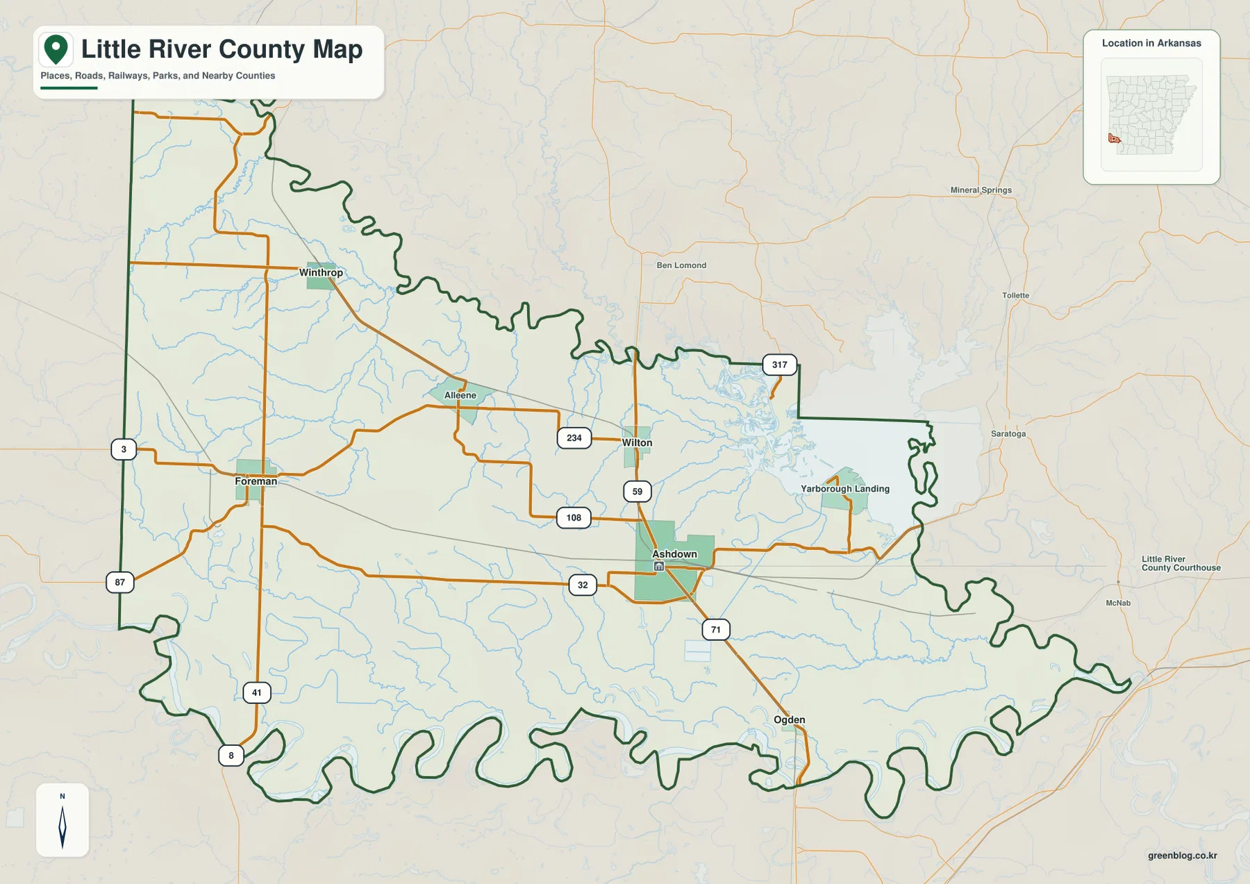
Located in far southwestern Arkansas, Little River County is defined by its irregular borders shaped by the Little and Red Rivers. Centered on the county seat of Ashdown, the area features a distinct topography where western interiors rise to over 146 meters while eastern river corridors remain lower.
Topography and Water Systems
The landscape varies significantly across the county, with rolling high ground in the west contrasting against the flat terrain along the eastern and southern waterways. Ashdown serves as the primary reference point, situated between two major river systems that form significant portions of the county's boundary. Major transportation routes, including Routes 32, 71, and 59, converge near Ashdown, connecting it to nearby communities like Wilton to the north and Ogden to the south. In the western interior, roads such as Route 3 wind through areas with more frequent bends compared to the simpler road segments found in the lower eastern regions.
Water Features and Elevation
Millwood Lake dominates the northeastern side of the county, acting as a clear landmark alongside the Little River system. The water map reveals a complex network of streams, including Lick Creek, Mill Creek, Caney Creek, and Hudson Creek, which traverse different elevations before joining the larger river systems. Elevation data indicates a range of approximately 70 to 146 meters, with the highest terrain concentrated around Foreman in the west. While not mountainous, the county offers a clear gradient from the elevated western hills down toward the lowland river edges.


0 댓글