
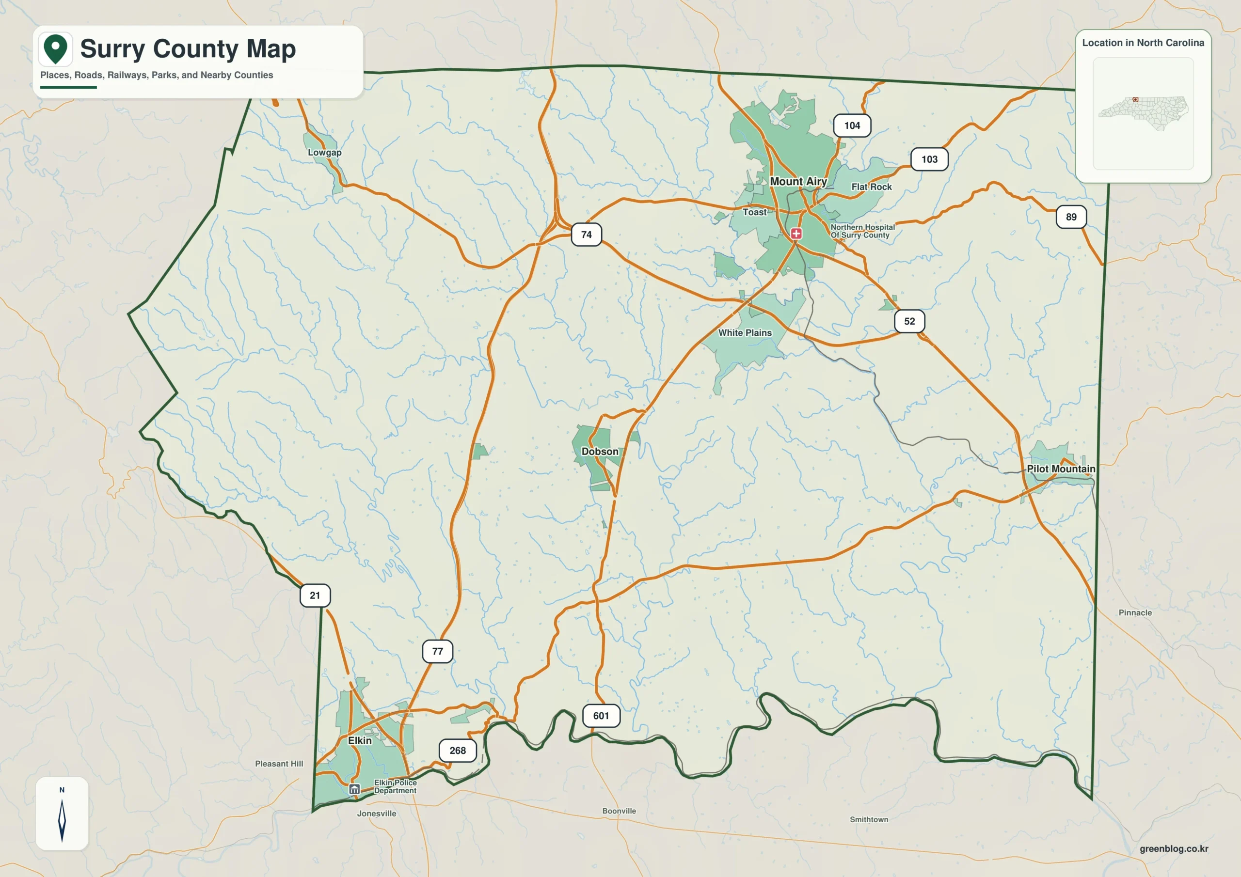
Surry County, situated on North Carolina's northern edge where foothills meet the Piedmont, is best understood not as a single point but through four distinct reference locations: Mount Airy, Dobson, Elkin, and Pilot Mountain.
Four Distinct Geographic Anchors
While Dobson serves as the administrative county seat in the central region, Mount Airy dominates the northern landscape as the largest urban area. To the southwest, Elkin anchors the Yadkin River corridor, and Pilot Mountain stands apart on the eastern side. This diversity is highlighted by specific road networks; Route 52 connects the north to the east, while Routes 21 and 268 define access near Elkin. The county's layout avoids a single central control, instead presenting a cluster of settlements where Mount Airy acts as a northern hub with distances extending 10,633 units to itself, 4,043 to Elkin, 1,652 to Dobson, and 1,483 to Pilot Mountain.
Rivers and Terrain Define the Landscape
Beyond roads, the physical geography is organized by major waterways and elevation changes. The Yadkin River forms a strong southern boundary, while the Fisher and Little Fisher rivers carve channels through the central-western interior. In the east, the Ararat River descends from the north, complemented by Jones Creek on the far edge. These water systems transform the county into a series of valleys rather than an empty rural block. Terrain shading reveals rougher ridges and valleys in the northern and western sections below the Virginia line, contrasting with the gentler slopes near Dobson. Although numerous lakes like Greenhill and City Lake dot the region, they serve as local references within this broader framework of river basins and mountain relief.


0 댓글