
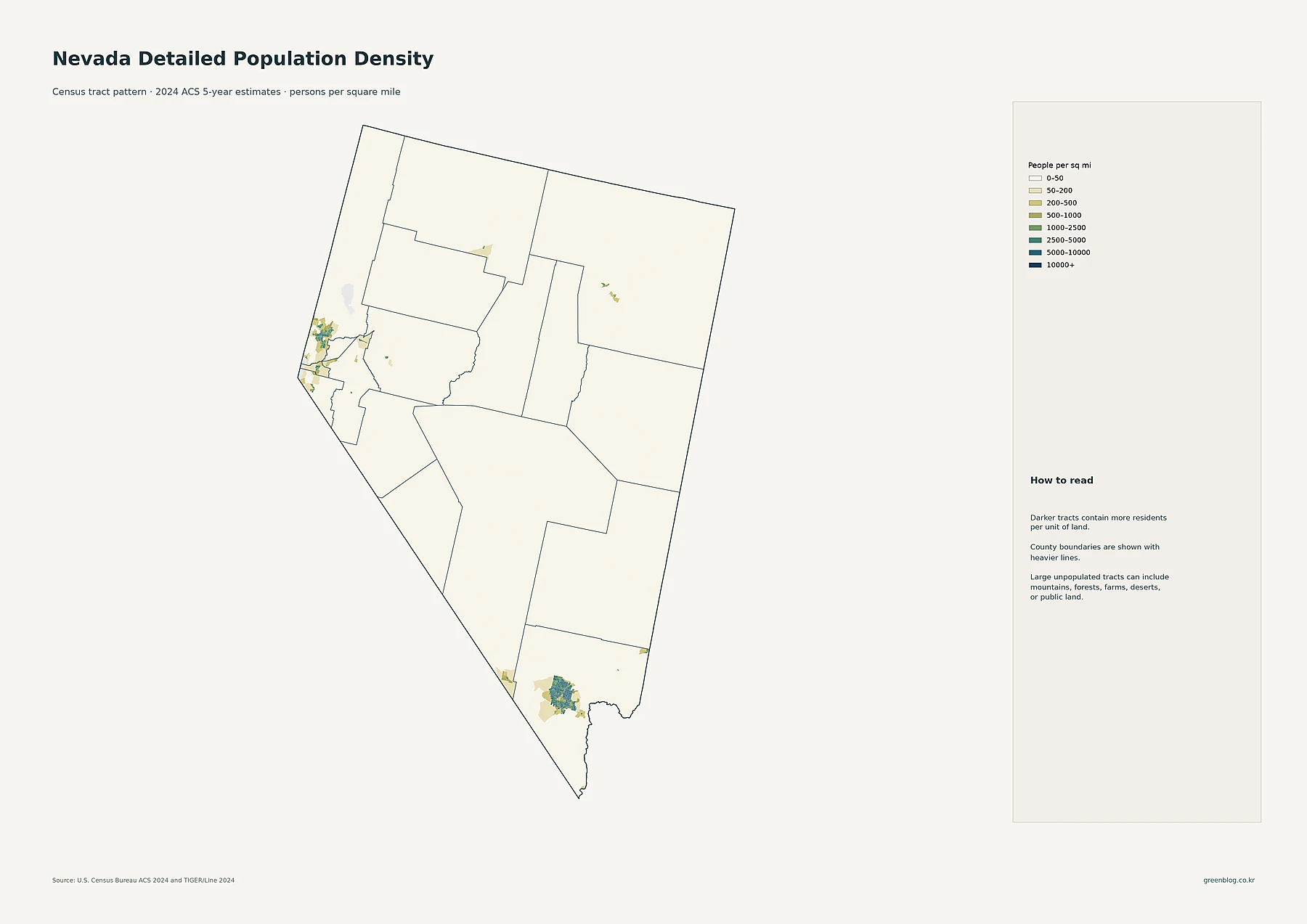
Nevada is defined by a stark contrast between its massive land area and the extreme concentration of its roughly 3.18 million residents into specific urban corridors, leaving the interior largely uninhabited.
The Two-Cluster Settlement Pattern
Despite covering approximately 109,860 square miles with an average density of just 29 people per square mile, Nevada's population is not evenly distributed. The state follows a distinct pattern where dense tracts cluster around Las Vegas in the south and Reno in the north, separated by enormous stretches of extremely low-density land. While Clark County dominates with over 2.3 million residents, Carson City holds the highest county-level density, and Nye County recorded the fastest percentage growth between 2010 and 2020. This extreme concentration within an otherwise sparse state is best understood by examining fine-scale tract data rather than relying solely on average figures.
City Sizes vs. Density Variations
Understanding Nevada requires distinguishing between total population size and density. Las Vegas leads as the largest census place with 660,400 residents, followed by Henderson and North Las Vegas, while Reno anchors the northern region with 273,212 people. Although several large communities like Enterprise and Spring Valley sit within the same metropolitan area, creating overlapping clusters on maps, their density varies significantly from surrounding tracts. For instance, a county can have a very low overall average while containing compact towns much denser than the land around them. The 2024 ACS data reveals that while Las Vegas dominates in absolute numbers, smaller communities like Summerlin South and Winchester still contribute to the state's unique settlement architecture.


0 댓글