
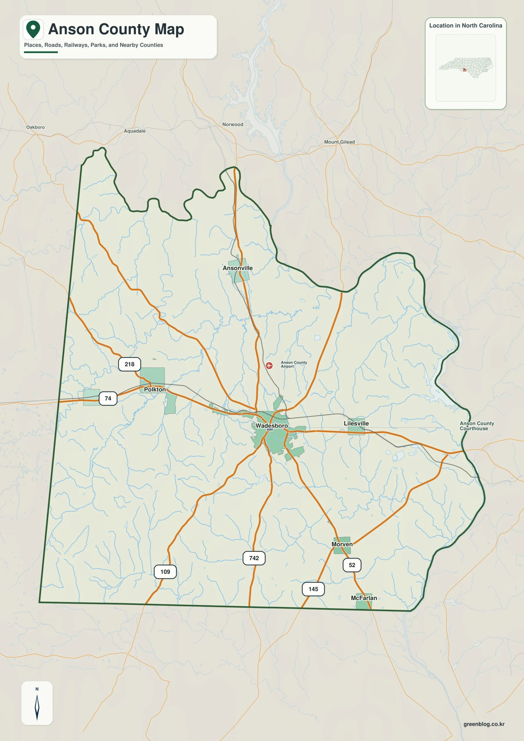
Anson County sits at a geographic crossroads in south-central North Carolina, anchored by the county seat of Wadesboro. This rural region straddles the transition between the rolling Piedmont and the gentler Coastal Plain, defined by major highways and distinct waterways.
Road Networks and Municipal Layout
The county's infrastructure is organized around two primary federal routes. US 74 serves as the dominant east-west corridor, connecting Polkton in the west through Wadesboro to Lilesville in the east. Perpendicular to this is US 52, which establishes the north-south axis linking Ansonville and the southern settlements of Morven and McFarlan. These highways intersect near the county seat, making Wadesboro a natural hub for travelers. While the comprehensive plan identifies seven incorporated places including Peachland, the map highlights six major settlements: Wadesboro, Polkton, Lilesville, Ansonville, Morven, and McFarlan. It is important to note that these locations are legally classified as towns rather than cities, though they function as significant community centers within the vast rural landscape.
Terrain Features and Water Systems
Beyond the paved roads, the physical geography of Anson County is shaped by its position between two distinct landforms. The terrain shifts from the rolling farmland of the middle and western sections to a gentler slope in the southeast. This transition is punctuated by major river valleys that create significant local relief. Water systems play a crucial role in defining the county's boundaries and drainage patterns. The Pee Dee River forms the eastern border, while Brown Creek and Jones Creek organize much of the interior drainage. In the northwest, Lanes and Richardson creeks channel water toward the Rocky River, illustrating how the natural landscape complements the human road network.


0 댓글