
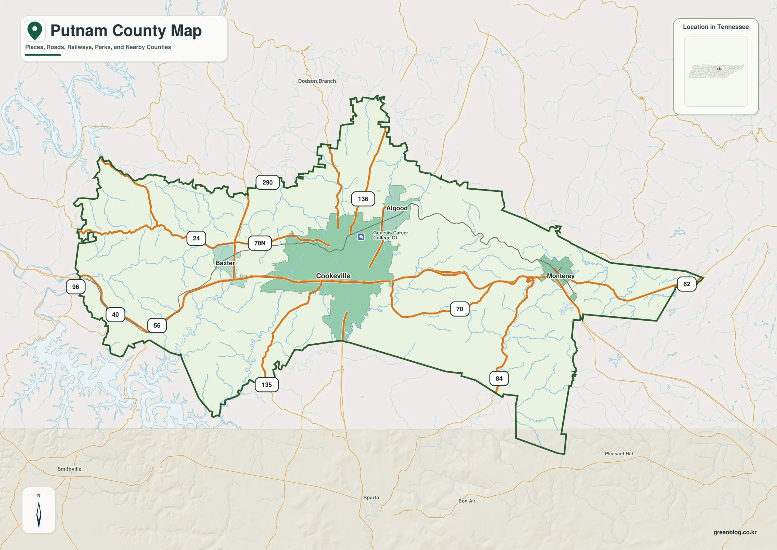
Explore the geographic diversity of Putnam County through its detailed mapping resources, which highlight the distinct transition from lower western valleys to higher eastern ridges centered around Cookeville.
Settlement Patterns and Road Networks
Cookeville serves as the primary reference point for understanding the county's layout, situated near the center of its populated areas. It forms a clear east-west settlement pattern alongside Algood to the northeast, Baxter to the west, and Monterey further east. Major transportation routes like I-40 provide the clearest cross-county connection, passing through Baxter, Cookeville, and toward Monterey. While roads around Baxter traverse lower, open terrain, those near Monterey navigate narrow valleys in higher country, creating a noticeable difference in road patterns. The county's road network spreads in multiple directions rather than following a single corridor, with extensions dropping south of the main east-west body that cannot be fully understood by looking only at the urban footprint.
Elevation Changes and Water Features
The landscape is defined by significant elevation changes ranging from approximately 145 to 623 meters. The eastern side features broad tan and brown ridges broken by thin green drainage corridors, contrasting with the generally lower ground in the central and western areas. Key water features include the Falling Water River near the southern boundary, along with Little Indian Creek, Mine Lick Creek, and Cane Creek occupying separate valleys across the west. Cordell Hull Reservoir also appears outside the northwestern edge, offering a strong regional water reference. These geographical elements help visualize how settlement patterns adapt to the changing relief from creek valleys to higher eastern terrain.


0 댓글