
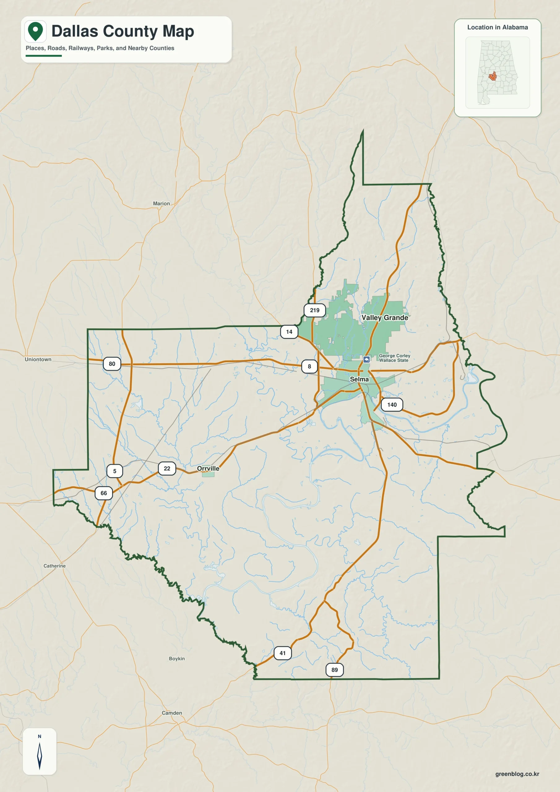
Dallas County in south-central Alabama is defined by its unique geography, centered on the city of Selma and shaped by the Alabama River. Understanding the relationship between this rural interior, major water systems, and elevation changes provides essential context for anyone exploring the region's landscape.
Geography, Settlements, and Transportation
The county's outline features a distinctive long northern projection, a broad western arm, and a rectangular southern section. Selma serves as the primary hub with a population of 17,057, situated slightly north of the county's middle. To its north lies Valley Grande (4,047 residents), approximately six miles away in a straight line, while Orrville (158 residents) anchors the southwestern side about fifteen miles southwest. The road network is dominated by U.S. 80, which crosses the county from west to east through Selma, alongside Alabama 22 connecting to Valley Grande and Orrville. Other routes including 5, 8, 14, 22, 41, 66, 80, 89, 140, and 219 form a hierarchy of connectors. It is important to note that straight-line distances differ from driving distances due to river crossings and winding rural routes.
Hydrology and Topography
Waterways are central to the county's character, with the Alabama River entering from the east and bending around Selma before continuing south. The Cahaba River joins from the northwest near Old Cahawba, an archaeological site associated with Alabama's first state capital. Major tributaries include Valley Creek in the north, Bogue Chitto Creek on the west, and Sopstone Creek on the southeast, alongside numerous lakes such as Bon Aire Lake, Mc Hugh Lake, and Dallas County Lake. The elevation map reveals a range from roughly 24 to 173 meters, with a mean of 58 meters. This terrain transitions from low river country in the south to higher ridges found in the north and southeast.


0 댓글