
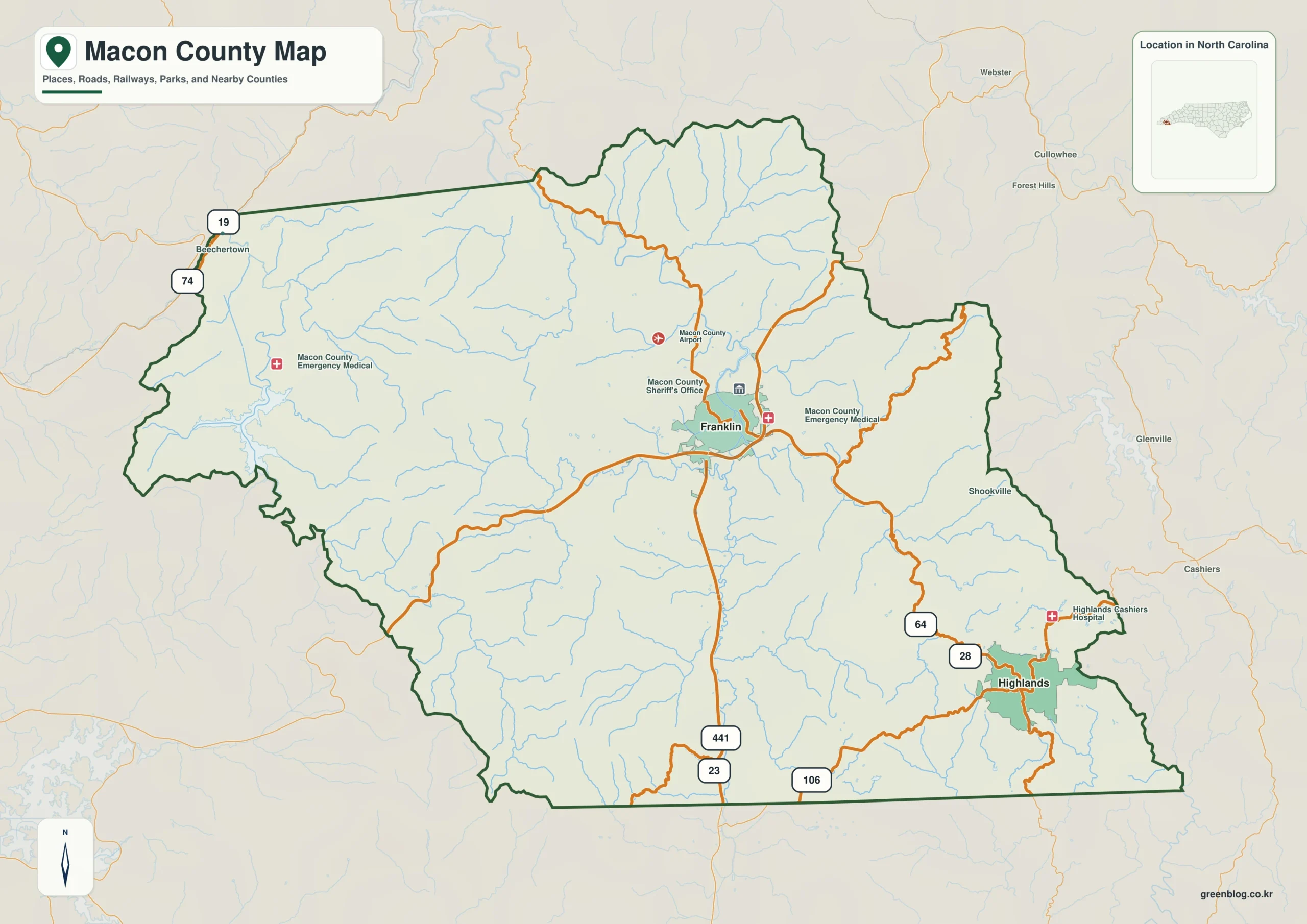
Understanding Macon County, North Carolina requires viewing it not as a single urban zone but as two distinct mountain centers separated by rugged terrain. Franklin serves as the central hub where major highways converge, while Highlands functions as an isolated southeastern settlement nestled within high elevations.
Geographic Divergence and Road Networks
The county's layout is defined by its position in southwestern North Carolina, bordered by Cherokee, Clay, Graham, Swain, and Jackson counties. Franklin acts as the primary service center located near the middle of the county, featuring U.S. Routes 23, 441, and 64 that run north-south or connect to the southeast. In contrast, Highlands is tucked into the southeastern mountains close to the state line, accessible via routes 28 and 106. The terrain creates a significant barrier between them; ridges and narrow valleys break up the interior, meaning straight-line distances often mask the length of winding road segments required to travel between these two centers.
Water Systems and Shaded Relief Context
The Little Tennessee River system acts as a unifying element, with Cartoogechaye Creek approaching Franklin from the west and the Cullasaja River defining the eastern side near Highlands. Other labeled waterways include Burningtown Creek, the Nantahala River in the southwest, and several lakes such as Lake Emory, Mint Lake, and Mirror Lake. Shaded relief imagery reveals why roads curve along these lower corridors rather than cutting across ridges. This visual context explains why a visitor planning a drive must consult both road maps and terrain-and-water layers to understand how valleys dictate travel routes through the steep Appalachian landscape.


0 댓글