
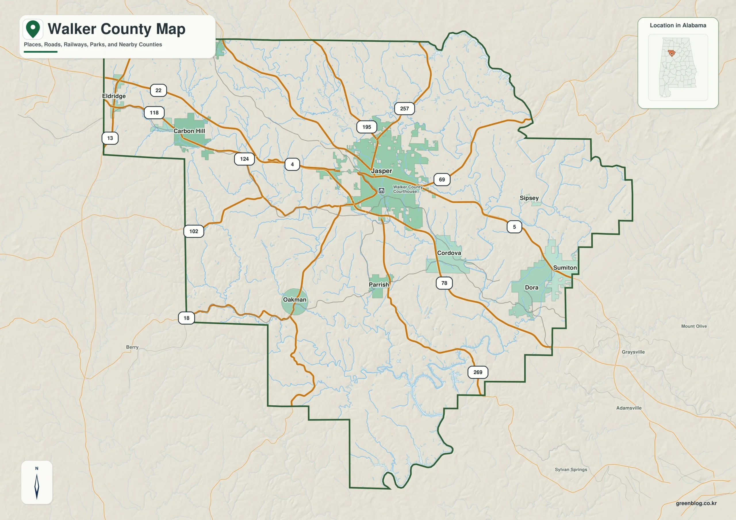
Walker County in northwestern Alabama presents a complex landscape where transportation routes intersect with deep stream valleys and varied elevations. Understanding the county requires looking beyond simple road networks to consider how water systems and historical mining geography have shaped its unique settlement pattern.
Geographic Context and Settlement Patterns
Located between Birmingham and the state's rural northwest, Walker County spans 791.03 square miles with a population estimated at 65,140 for July 2025. The county seat, Jasper, serves as the primary hub where major routes like I-22 and U.S. 78 converge. However, the settlement pattern is not uniform; it reflects an older industrial geography where former mining and railroad communities remain separated across the plateau. Communities such as Carbon Hill to the west, Cordova and Dora in the southeast, and Parrish and Oakman in the south form distinct local centers rather than a single continuous urban area.
The Role of Waterways and Elevation
The physical geography is defined by the Sipsey and Mulberry Fork systems, which cut through numerous smaller stream valleys including Blackwater Creek, Rock Creek, Bean River, and Lost Creek. These waterways are as significant as the roads because they dictate how the land is divided. The elevation data reveals a dramatic range from 43 to 246 meters, with a mean of 144 meters, highlighting high northern uplands contrasted against deeply cut stream valleys. This topographical variation explains why towns appearing close in straight-line position may actually occupy different travel corridors and environmental zones.
Download the Walker County Alabama Map ZIP file containing four high-resolution JPGs


0 댓글