
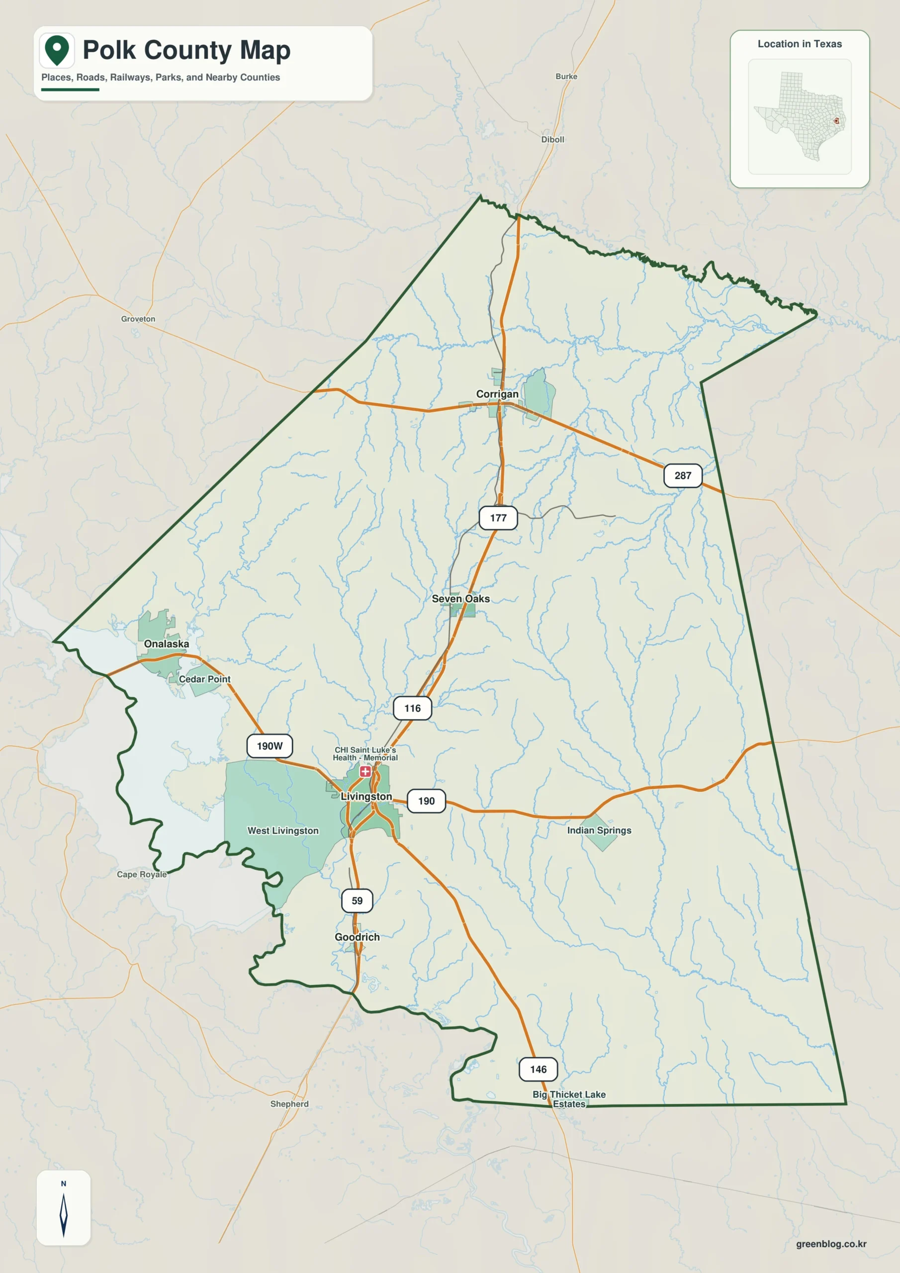
Explore Polk County through four distinct high-resolution maps centered on Livingston, offering a comprehensive view of the region's road networks, water systems, and topographical variations.
Geographic Orientation and Road Networks
Livingston serves as the primary anchor for understanding Polk County's layout, connecting major routes like U.S. 59 and U.S. 190 to surrounding communities such as Goodrich, Seven Oaks, Onalaska, and Corrigan. The county's road system extends beyond a simple north-south axis, featuring diagonal and east-west connections that link Livingston to rural eastern areas and neighboring towns like Burke, Diboll, and Shepherd. Beyond the county limits, orientation points include Groveton to the west and counties such as Trinity, Tyler, Hardin, Houston, Liberty, San Jacinto, and Angelina, providing essential context for regional navigation.
Hydrology and Topographical Features
Waterways define the county's landscape, with Lake Livingston dominating the western side alongside the Trinity River near the southwestern border. The Neches River marks the northeastern edge, while Piney Creek traverses the northern interior. Smaller named channels like Rocky Creek, Long King Creek, Bear Creek, Big Sandy Creek, and Menard Creek create a dense drainage network, complemented by numerous lakes including Folmar Lake, Dogwood Lake, and Lake Myrtle. Elevation data reveals a significant contrast between the low-lying western and southern margins (ranging from 13 to 151 meters) and the broken, ridged terrain found in the central and eastern parts of the county.


0 댓글