
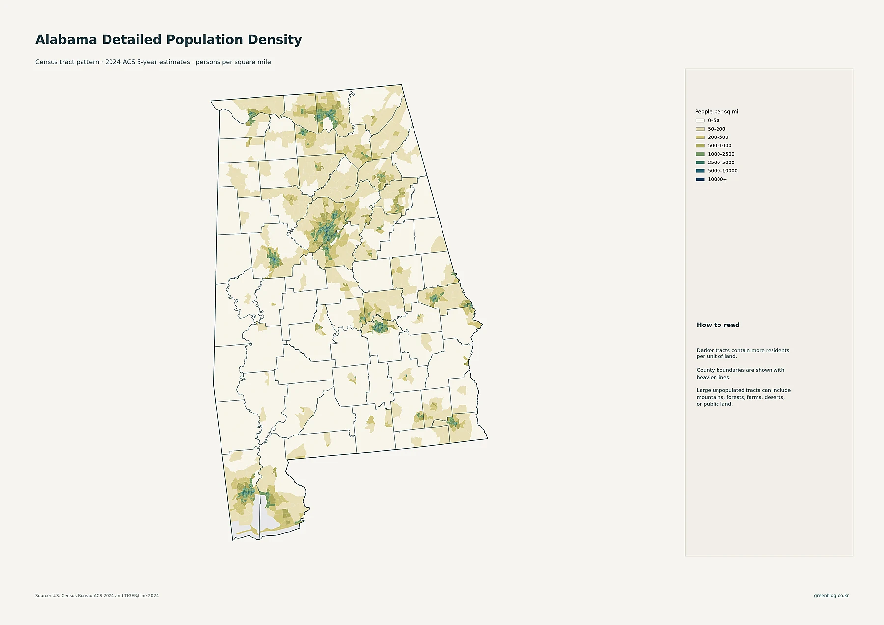
Alabama's population of over 5 million is not spread evenly across its landscape, creating a complex picture where some counties are densely packed while others remain vast and sparse. To truly understand the state, one must look beyond simple averages and examine how residents cluster in specific areas.
Visualizing Concentration: Tracts, Cities, and County Totals
The most detailed view comes from census tract maps, which reveal tight clusters of high-density living around major urban centers like Birmingham, Huntsville, and Mobile. While city circles show total population size—ranging from over 200,000 in Huntsville to roughly 57,000 in Decatur—their geography matters as much as their ranking. However, these maps do not tell the whole story because they measure crowding rather than total headcount. County-level data clarifies this distinction; Jefferson County holds the largest population at 667,755 residents, yet its density of 600.7 people per square mile is vastly different from Baldwin County's 246,989 residents spread over a much larger area with only 155.4 density. This contrast proves that total population and spatial crowding are distinct metrics.
Historical Trends: Growth and Decline Since 2010
Comparing the 2010 and 2020 decennial censuses reveals significant shifts in how people inhabit Alabama. Baldwin County experienced the most dramatic percentage increase at 27.2%, driven largely by migration, while Perry County saw the steepest decline of approximately -19.6%. These trends highlight that population change is not uniform; some regions like Limestone and Madison grew robustly, whereas others along the western and southwestern borders faced contraction. The statewide average density near 100 people per square mile serves as a useful reference point but fails to capture these sharp variations between booming urban corridors and shrinking rural zones.


0 댓글