
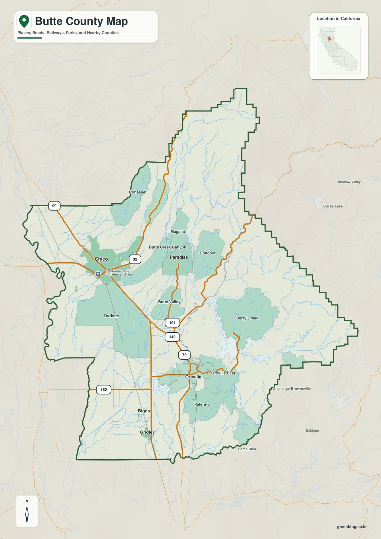
Butte County represents a dramatic geographic shift within northern California, transitioning from the expansive Sacramento Valley floor in the west to the rugged Sierra Nevada mountains in the east. This unique landscape is anchored by two distinct urban centers: Chico, situated on the broad valley floor, and Oroville, located at the foothill edge where the Feather River system begins.
Topographic Progression and Urban Distribution
The county's geography is defined by three broad topographic areas: the western valley, the transitional foothills, and the eastern mountain region. Chico serves as the primary urban anchor on the flat valley floor, characterized by wide roads and gentle terrain where communities like Durham and Biggs extend southward. In contrast, Oroville marks the critical transition point near Highway 70 and Route 162, acting as a gateway to Lake Oroville and the Feather River recreation areas. Moving eastward from Chico, the landscape becomes increasingly dissected by Butte Creek Canyon and narrow drainage lines, leading to rougher terrain in Paradise, Magalia, and Concow. While Chico is the largest incorporated city with over 102,000 residents, Oroville holds the distinction of being the county seat with nearly 20,000 inhabitants, surrounded by significant reservoirs and rugged drainage country.
Mapping the Transition Without Elevation Data
Understanding this terrain requires interpreting visible relief shading rather than relying on a separate elevation map, which is not included in the available reference package. The county's General Plan clearly delineates the shift from the low valley to the mountain interior, where long ridges and Feather River tributaries dominate the northeastern half of the region. Although demographic data for Oroville shows a population of 19,752 compared to Chico's 102,188, the eastern portion of the county appears visually much larger due to its rugged topography and sparse settlement labels. Highways 99 and 32 facilitate movement through the western corridor, while Route 162 connects the foothills near Oroville to the mountain interior, guiding travelers from the dense road network of the valley into the steep canyons that replace the open landscape.


0 댓글