
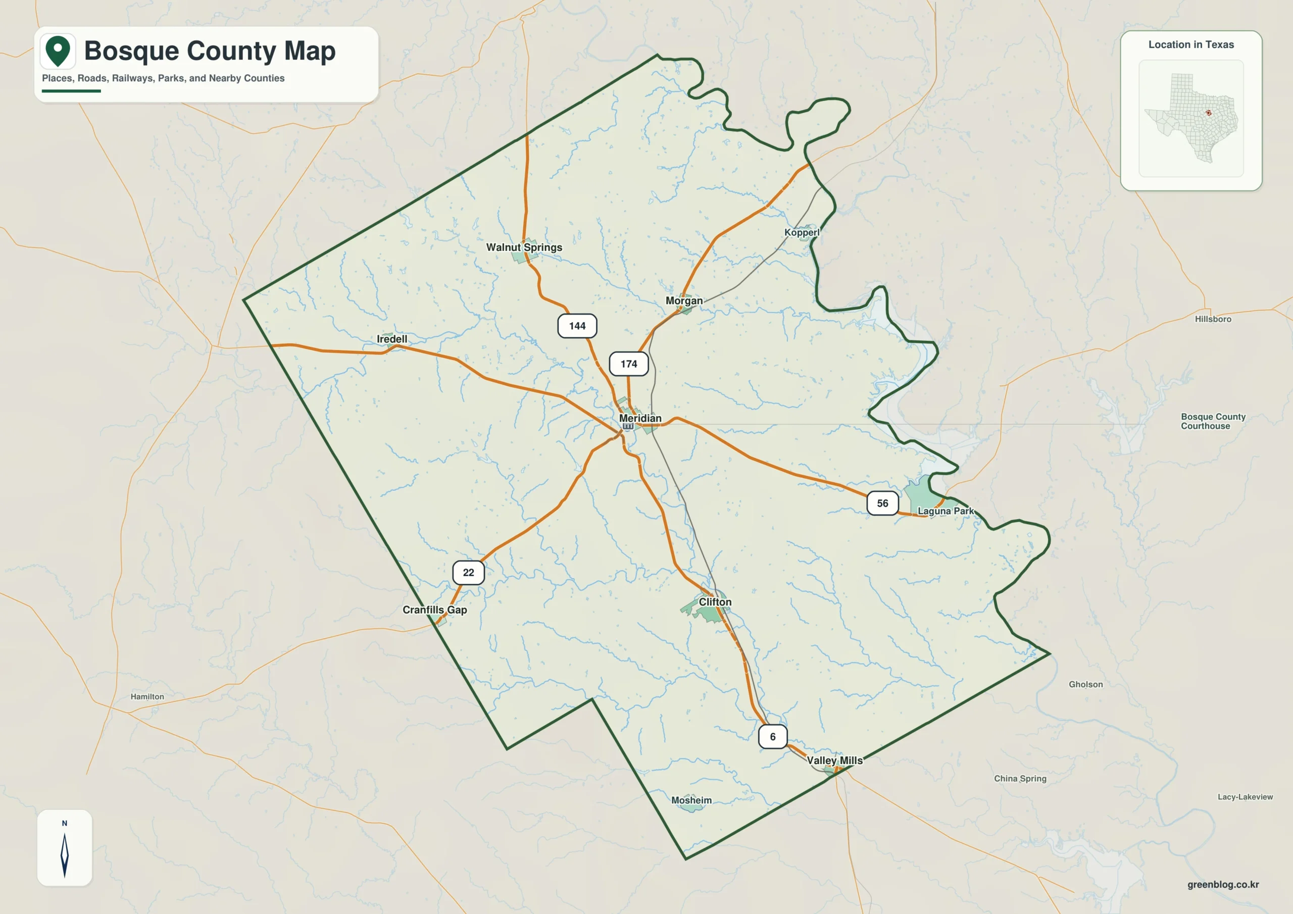
Bosque County in north-central Texas offers a landscape defined by scattered small towns rather than a single urban hub. Understanding the county's layout requires looking at its road networks, major communities like Clifton and Meridian, the intricate North Bosque River system, and the shifting elevation from western hills to eastern plains.
Roads, Communities, and Elevation
Meridian serves as the ideal central orientation point where several numbered highways intersect, including routes 6, 22, 144, 174, and 56. This hub connects the county's diverse settlements, ranging from Clifton in the south to Walnut Springs and Morgan in the north. While Clifton is the largest community with approximately 3,503 residents, Meridian follows closely behind at roughly 1,638 people. The general map reveals that Bosque County has an irregular shape, with neighboring areas like Hamilton and Somervell bordering its eastern and western edges. Travelers should note that smaller towns such as Iredell, Kopperl, and Laguna Park appear on the general map but are excluded from the primary city ranking.
Waterways and Topography
The county's geography is heavily influenced by its water systems, particularly the North Bosque River which flows through the center and collects numerous creeks including Spring Creek, Meridian Creek, and Childress Creek. The East Bosque River is located in the northwestern section. Elevation changes significantly across the region, with higher western hills gradually descending into lower ground toward the east near Laguna Park and Lake Whitney. These topographical features are critical for trip planning, as they dictate drainage patterns and travel routes between the various communities scattered across this broad rural county.
Download High-Resolution A3 JPG Files for Printing or Planning


0 댓글