
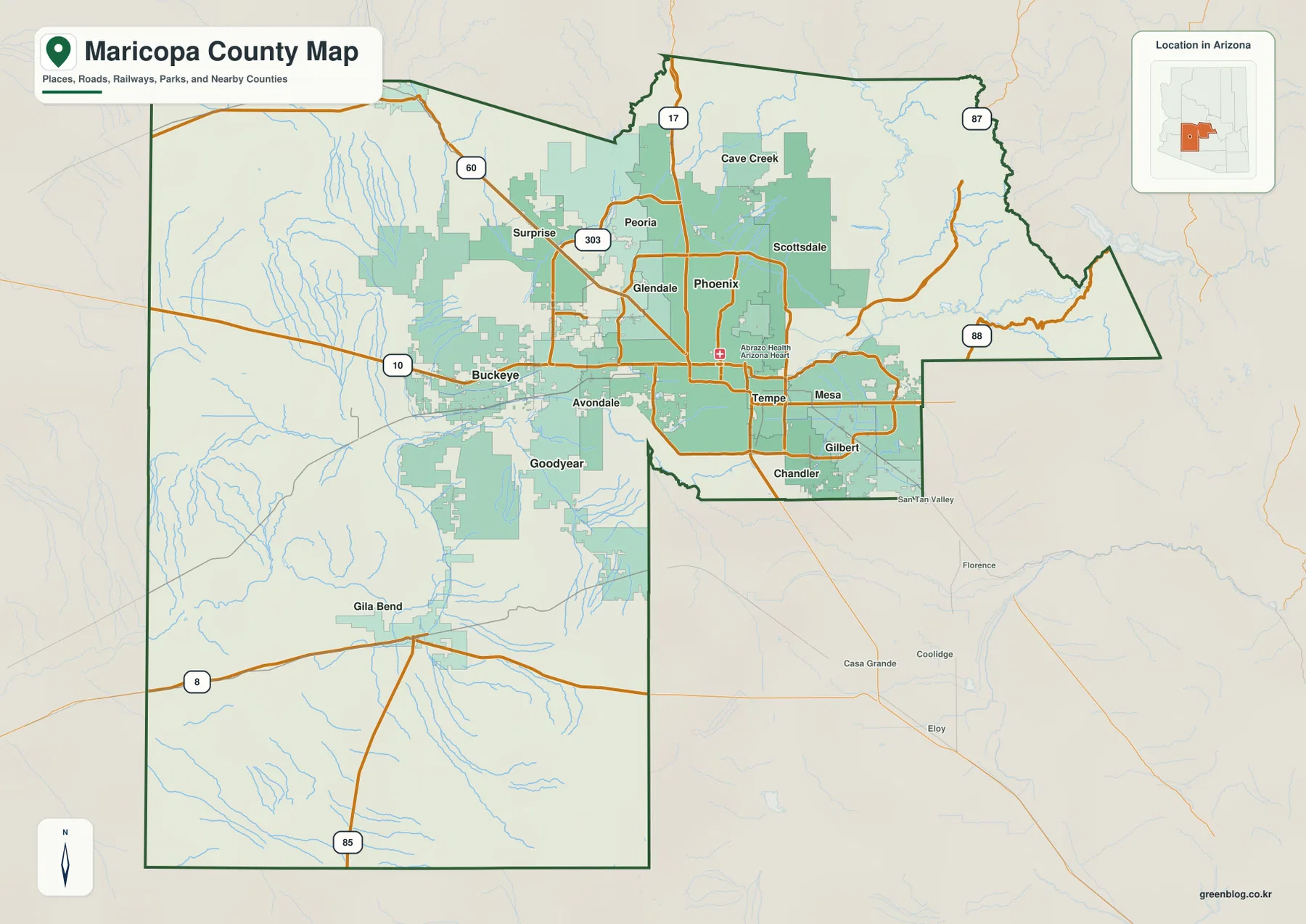
Maricopa County presents a striking geographical contrast where a dense urban core sits at the center, surrounded by expansive desert and mountainous terrain. Phoenix anchors this metropolitan cluster, but the county boundary extends far beyond these developed areas into sparsely settled regions.
The Urban Core and Metropolitan Spread
A broad continuous urban area fills the middle of the county, featuring tightly clustered cities like Phoenix, Mesa, Gilbert, Chandler, Scottsdale, Glendale, Tempe, Peoria, and several western suburbs. Major highways such as Interstate 10 and Interstate 17 traverse this developed zone, connecting communities while Loop 303 circles the western suburbs. In sharp contrast, the county boundary reaches well west and southwest into much less urban land, creating a shape with a broad western block and a narrower eastern projection. This separation means Maricopa County is more than just a map of metropolitan Phoenix; it includes long stretches of lower desert, isolated ridges, river washes, and a significantly higher northeastern margin.
Waterways and Topographical Shifts
Beyond the city limits, three major rivers define the county's terrain: the Salt River enters from the east following lower terrain toward the center, while the Gila River crosses the south-central area continuing west. The Verde River also connects the low basin to higher country, illustrating how waterways link different elevations. The terrain-and-water map reveals that elevation changes sharply as one moves from the central basin toward the northeastern mountains. These geographical features transform the landscape from a developed grid into rugged, open country, emphasizing the vast difference between the county's urban heart and its remote periphery.


0 댓글