
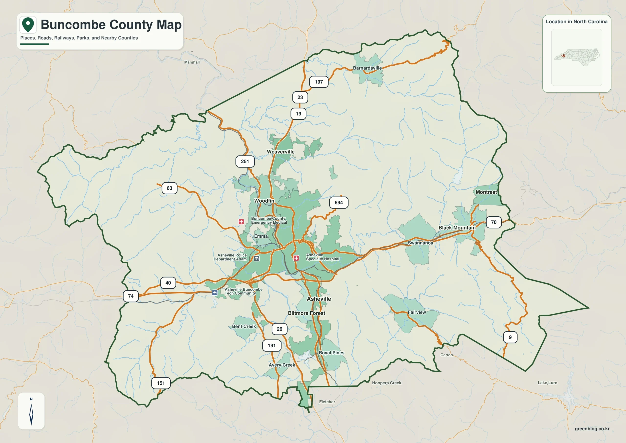
Understanding Buncombe County requires viewing Asheville not as an isolated city, but as the heart of a complex network where dense roadways intersect with rugged mountain terrain and flowing rivers.
The Interplay of Roads, Rivers, and Settlements
The county's layout is defined by how major highways like I-40 and I-26 connect the Asheville basin to the wider region. While the urban area features a concentrated web of roads, the landscape shifts dramatically toward the outer boundaries into widely spaced communities and difficult terrain. The French Broad River anchors the central region, while the Swannanoa River approaches from the east, creating distinct valleys that dictate settlement patterns. Major towns such as Woodfin and Weaverville extend the urban footprint northward, whereas Black Mountain and Montreat establish a separate eastern node in a different mountain setting. To the south, Biltmore Forest sits close to Asheville, illustrating that the built environment does not form a single flat grid but rather several valley-based groups linked by mountain roads.
Choosing the Right Map for Your Needs
Three specific maps serve different purposes without turning into technical reports. The boundary-and-road map is essential for locating communities and routes, showing how Asheville occupies the south-central part surrounded by the densest cluster of infrastructure. The city map simplifies this complexity by highlighting six major places: Asheville, Black Mountain, Woodfin, Weaverville, Biltmore Forest, and Montreat, clarifying their relative positions. Finally, the terrain-and-water map reveals the physical setting, displaying mountain relief, creeks, reservoirs, and lakes that shape the landscape. Whether for understanding flood risks or simply appreciating the geography, these resources allow readers to answer specific questions about the county's unique structure.


0 댓글