
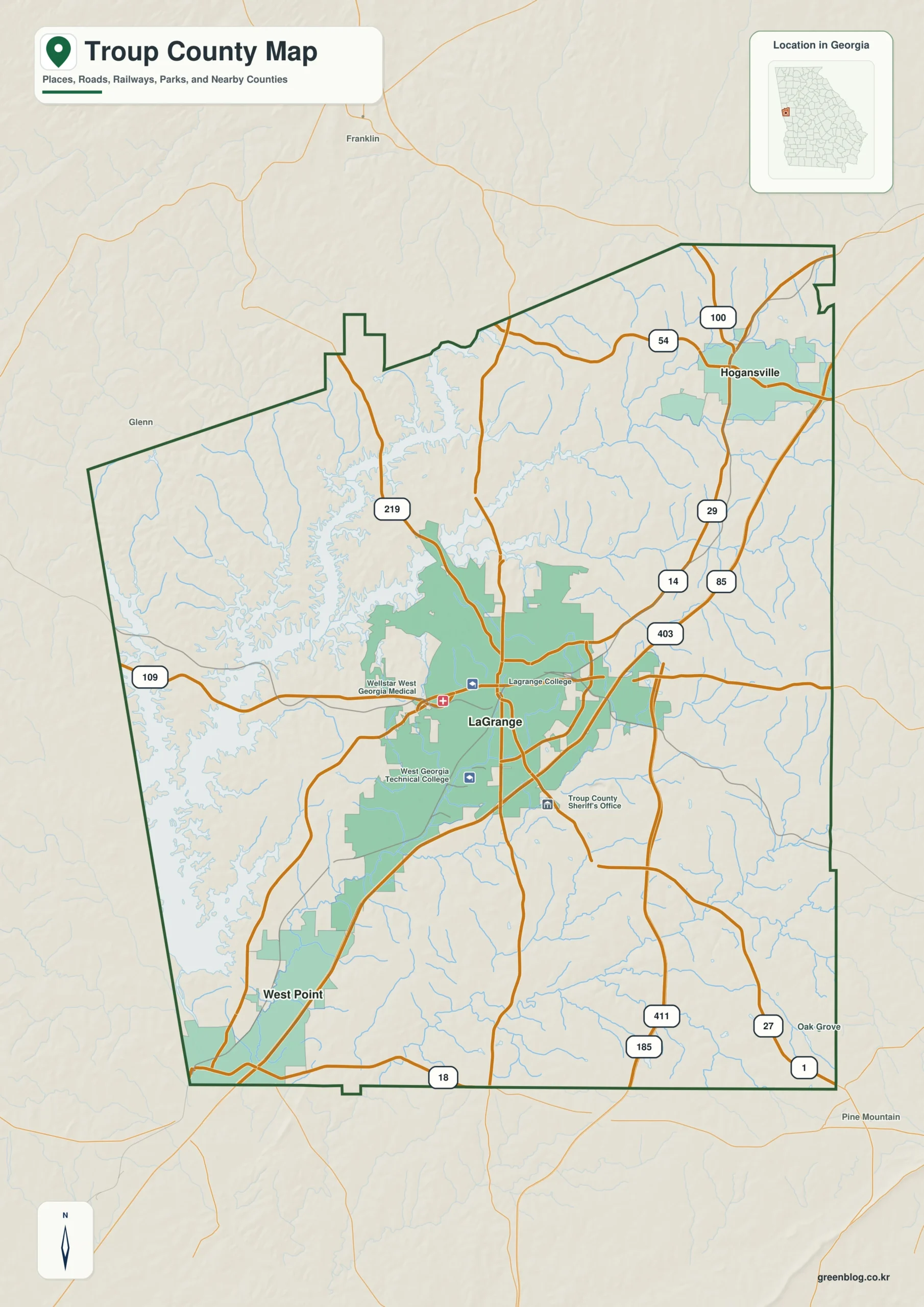
Troup County in western Georgia is defined by a distinct geographic split between its water-rich western corridor and its rugged eastern ridges. With LaGrange serving as the central hub, the county offers unique landscapes ranging from the expansive West Point Lake system to the higher elevations near Hogansville.
The Three Pillars of Troup County Geography
Understanding Troup County requires looking at three key locations: LaGrange, West Point, and Hogansville. LaGrange acts as the primary urban center, situated inland with a dense network of major roads including Interstate 85 and Route 109. To its southwest lies West Point, located near the Alabama border where the Chattahoochee River meets West Point Lake. In the northeast, Hogansville sits along the I-85 corridor. While straight-line distances place West Point about 12 miles from LaGrange and Hogansville roughly 13 miles away, these figures represent direct points rather than driving routes. Population data highlights LaGrange's dominance with over 32,000 residents compared to the smaller towns of West Point and Hogansville.
Waterways and Elevation Contrasts
The physical landscape of Troup County is dominated by a sharp contrast between its western and eastern sides. The west side features a broad, branching water system where West Point Lake fills the county with long coves extending from the Chattahoochee River. This low-lying area is marked by numerous smaller ponds like Daniels Pond and Sherwood Lake. Moving eastward, the terrain shifts dramatically to higher elevations ranging from 131 to 292 meters. The eastern side is characterized by closely spaced ridges and narrow valleys, which host creeks such as Yellow Jacket Creek in the northeast and Flat Shoals Creek in the southeast. This elevation gradient explains the drainage patterns, with streams flowing westward toward the lake system.


0 댓글