
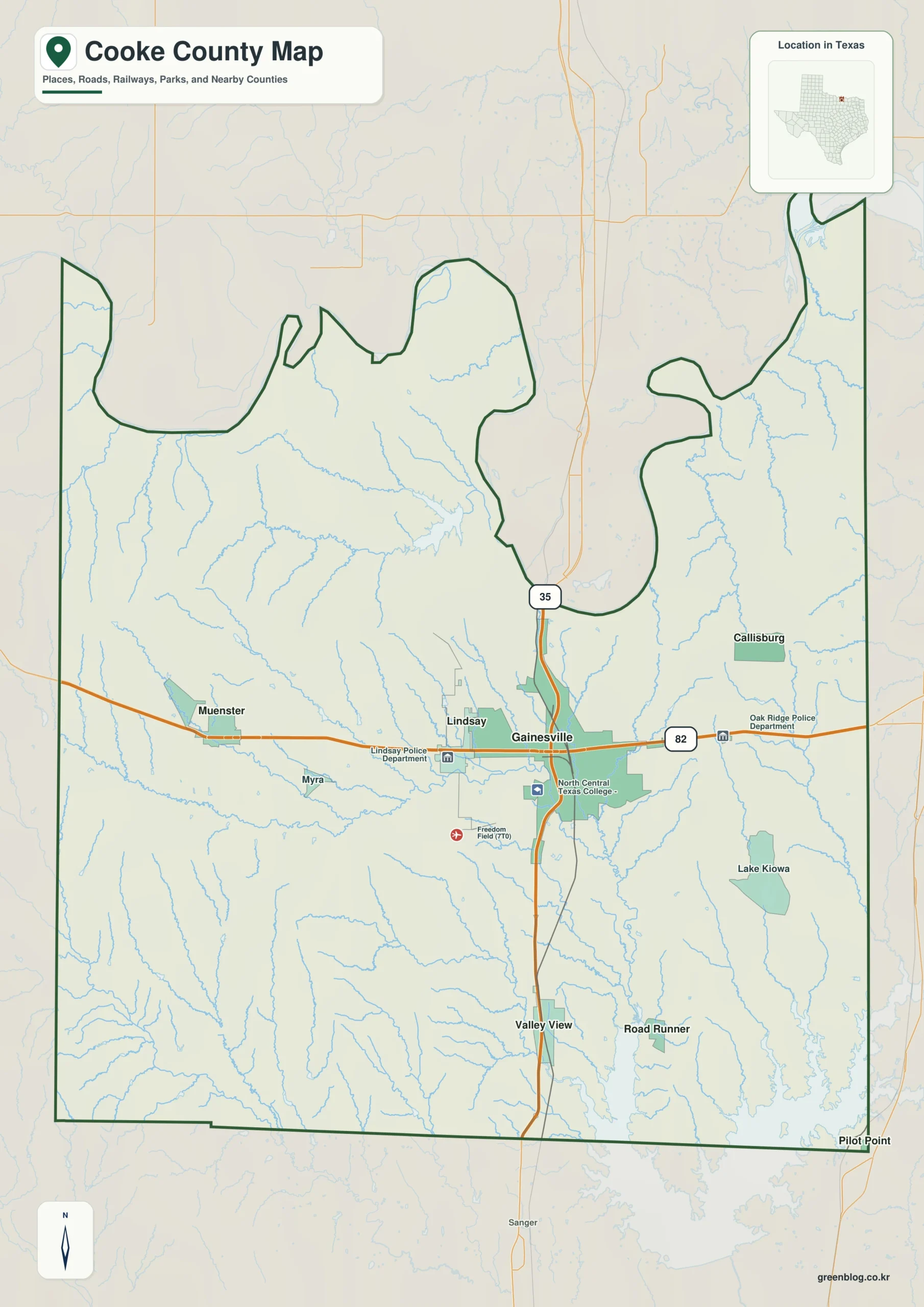
Cooke County in North Texas offers a distinct geographic journey, defined by the busy intersection of Interstate 35 and US 82 at Gainesville, which serves as the primary orientation point for visitors navigating this region.
Roads, Cities, and the Northern Boundary
The county's layout is anchored by major transportation corridors. Interstate 35 runs north-south through Gainesville, while US 82 stretches east-west, connecting key communities such as Muenster and Lindsay to the west, and Callisburg to the east. The northern edge of the county follows the winding Red River, creating an irregular border that separates the region from neighboring states. South of this river, the landscape transitions into lower terrain featuring lakes like Hubert H Moss Lake and Ray Roberts Lake, with smaller towns such as Valley View and Road Runner providing southern references. North Central Texas College and Freedom Field are notable landmarks near the crossroads in Gainesville.
Elevation and Water Systems
The physical geography of Cooke County is characterized by a significant elevation difference between its western uplands and southeastern lowlands. Elevation ranges from approximately 183 meters in the southeast to about 382 meters in the west, with an average height near 255 meters. This contrast highlights the rugged hills in the western half, which are cut by narrow creeks like Elm Fork Trinity River and Brushy Elm Creek. In contrast, the southeastern area is dominated by broad lake-and-creek lowlands, including Pecan Creek, Indian Creek, and Timber Creek, which feed into Ray Roberts Lake. The terrain map illustrates how water bodies organize the landscape, distinguishing the high western zones from the extensive drainage country found near the Red River.


0 댓글