
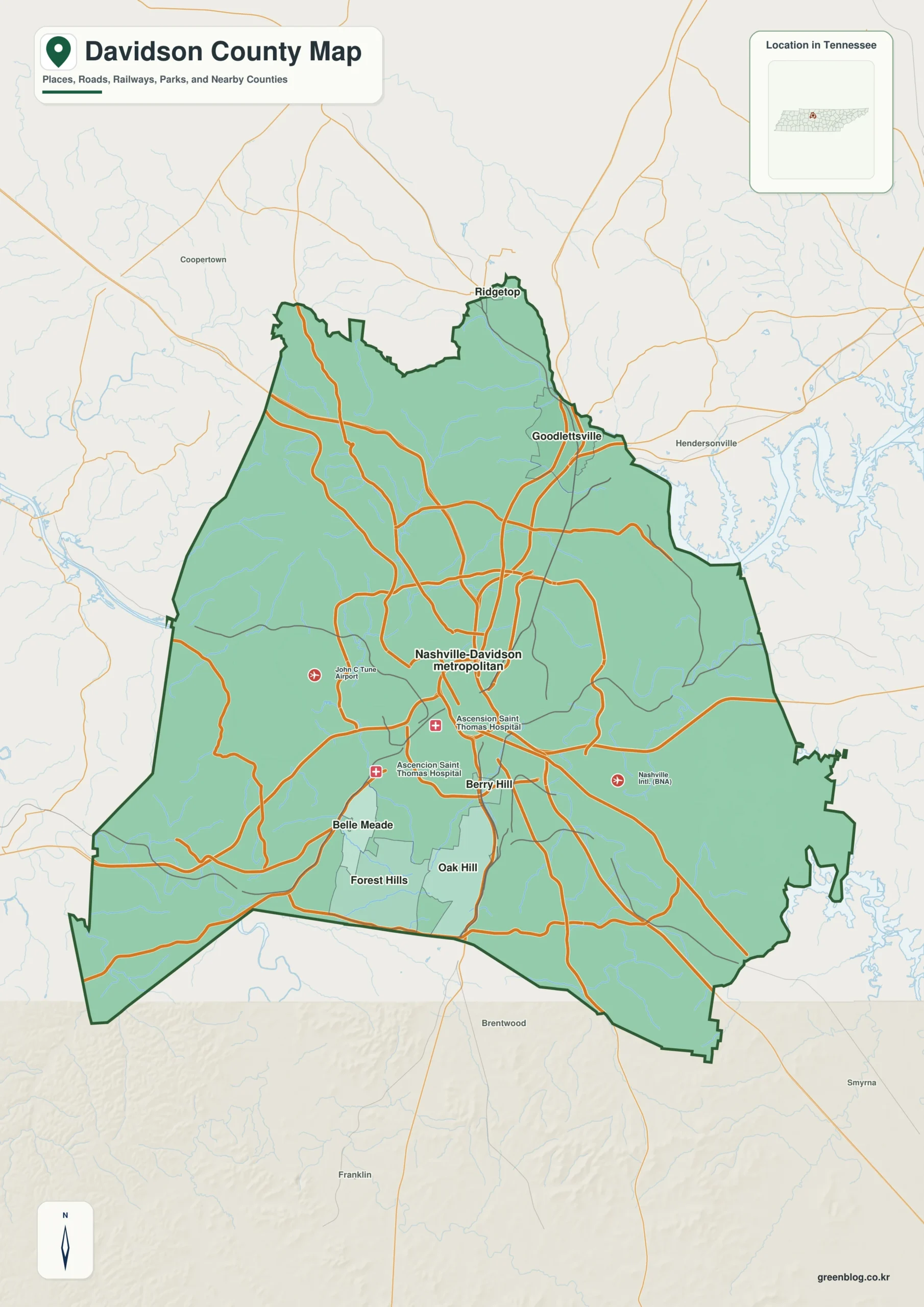
Understanding Davidson County requires looking beyond Nashville's central dominance to see how the Cumberland River, reservoirs, and elevation changes shape the region's geography.
Urban Layout and Municipal Boundaries
While Nashville anchors the county's road network with major routes like I-24, I-40, and US 31, the true clarity of Davidson County emerges when viewing smaller municipalities alongside the river. To the south, a compact cluster includes Belle Meade, Forest Hills, Oak Hill, and Berry Hill, while Goodlettsville and Ridgetop define the northern edge. The map distinguishes these areas from neighboring counties such as Robertson, Sumner, Wilson, Rutherford, Williamson, and Cheatham, which border Davidson County on various sides. This distinction is vital because continuous development often blurs administrative lines, making it difficult to determine if a location lies within Davidson County or merely in the broader Nashville metropolitan area.
Water Features and Topographical Relief
The county's geography is defined by its water systems, particularly the Cumberland River, which makes broad bends across the region and dominates the eastern view through Percy Priest Reservoir. Smaller bodies like Woods Lake, Cheek Lake, Radnor Lake, and several creeks add complexity to the landscape, while the Harpeth River marks the southwestern edge. Elevation varies significantly from 24 meters in river valleys to 349 meters on higher ridges found in the northwestern and southern sections. This relief creates a varied terrain that contrasts sharply with the flat urban corridors of Nashville, offering a landscape far more diverse than a simple city outline suggests.


0 댓글