
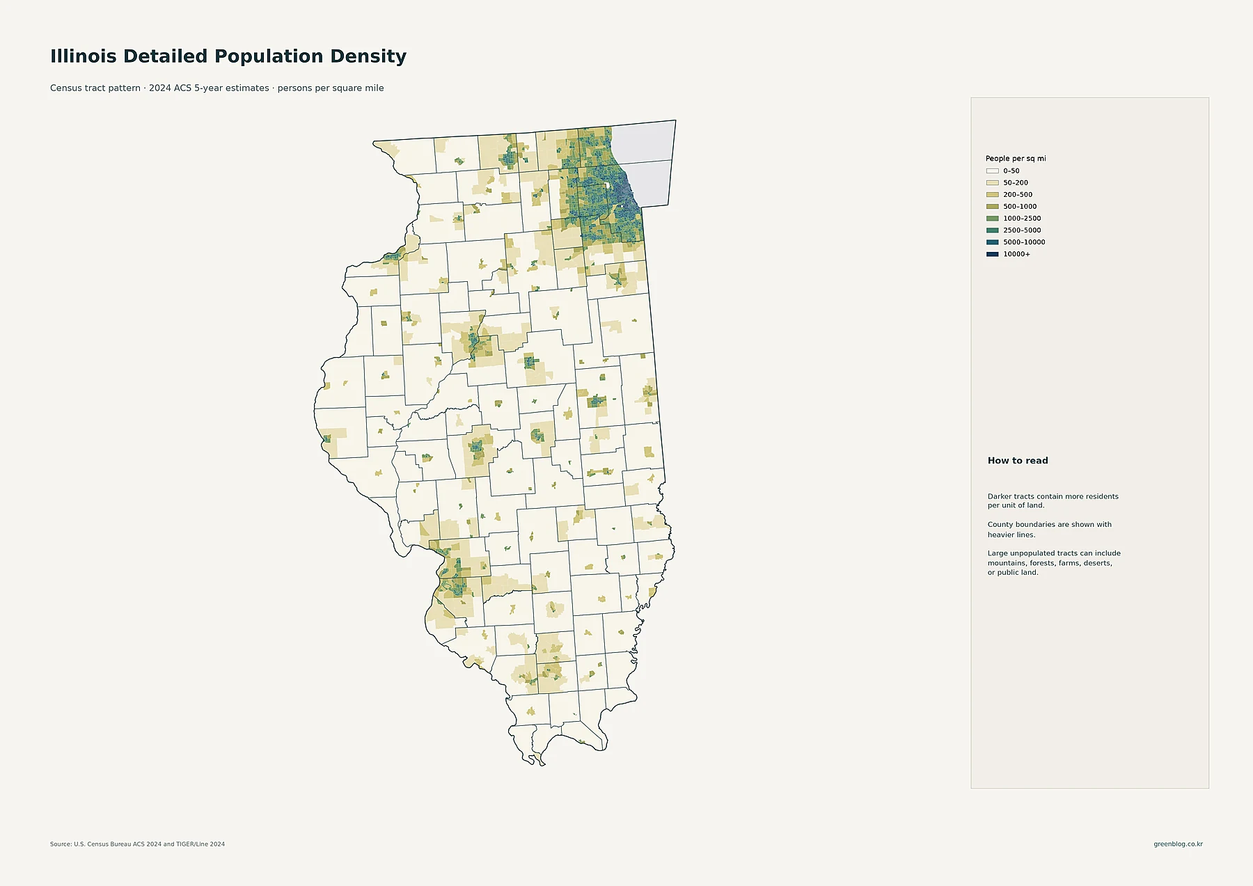
Illinois presents a stark geographic paradox where a statewide average of 229 people per square mile masks extreme regional disparities. With over 12.6 million residents, the state is defined by a massive urban concentration in the northeast and scattered settlements elsewhere.
The Northeast Core vs. The Rest of the State
Population distribution reveals that Cook County dominates with nearly 5.2 million residents, boasting an extraordinary density of roughly 5,484 people per square mile. This intense concentration extends into DuPage and Lake counties, creating a continuous high-density zone that contrasts sharply with central and southern Illinois. While cities like Peoria, Champaign, and Springfield form distinct urban clusters, the majority of the state's land area remains sparsely populated. The 2010–2020 decade further illustrates this dynamic; although Kendall County experienced robust growth at +14.9%, even major northeastern counties saw only modest percentage increases around 1.5% to 1.7%. This data confirms that Illinois is less a uniformly populated agricultural state and more a region dominated by one massive metropolitan area plus isolated urban nodes.
Understanding the Metrics
Interpreting these maps requires distinguishing between total population, density, and growth rates. County totals highlight Cook's overwhelming scale compared to neighbors like Winnebago or Madison, but circle size on city maps reflects absolute numbers rather than density. For instance, Chicago holds approximately 2.71 million people, far exceeding Aurora at roughly 180,000. Meanwhile, the county choropleth map clarifies that while Cook is the densest, other regions like Peoria and Sangamon maintain higher densities than the rural south. The statewide average of 229 per square mile should never be used to describe local living conditions, as a resident in Cook faces a completely different environment than one in Alexander County, which recorded the state's largest population decline.


0 댓글