
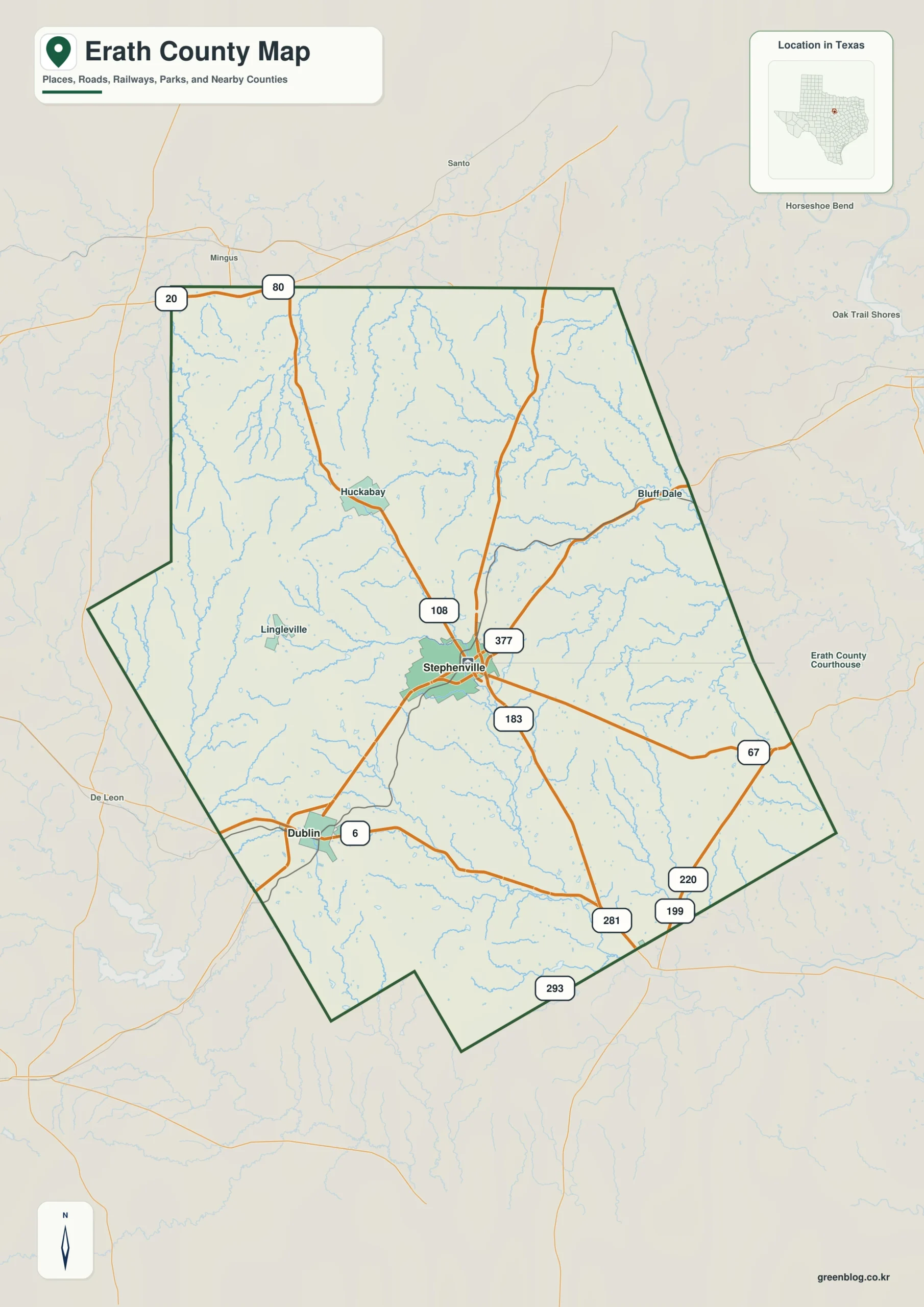
Understanding Erath County requires looking beyond a single road map, as the landscape is defined by its complex interplay of highways, branching river systems, and significant elevation changes from west to east.
Geographic Layout and Transportation
The county's structure centers on Stephenville, which acts as a major hub where U.S. Highways 377 and 281 converge with State Highway 108. While Dublin serves as the primary population center to the southwest, smaller communities like Bluff Dale, Huckabay, and Lingleville are scattered across broad rural interiors rather than forming a continuous settlement belt. The county boundary itself is irregular, featuring distinct bends on the western and southern edges, while Interstate 20 and U.S. Route 80 run parallel just north of the border as regional references. Unlike the concentrated road network, the water system is far more branched, with the North Bosque River dominating the central and southern regions alongside its South Fork and Round Hole Branch.
Elevation and Hydrology
A critical feature of Erath County is the dramatic drop in elevation from approximately 509 meters in the western uplands to roughly 251 meters in the eastern valleys, with an average height of 382 meters. This topographic gradient explains why the eastern half displays dense drainage relief carved by numerous small channels, whereas the west remains higher and more dissected. The water map reveals that the northeastern quadrant drains separately through the North and South Paluxy Rivers, creating distinct headwater networks compared to the rest of the county. Key landmarks such as Kiker Lake, Bates Lake, and Thurber Lake provide additional orientation points, while the elevation data helps clarify why certain areas feel rugged or open depending on their proximity to these deep valleys.


0 댓글