
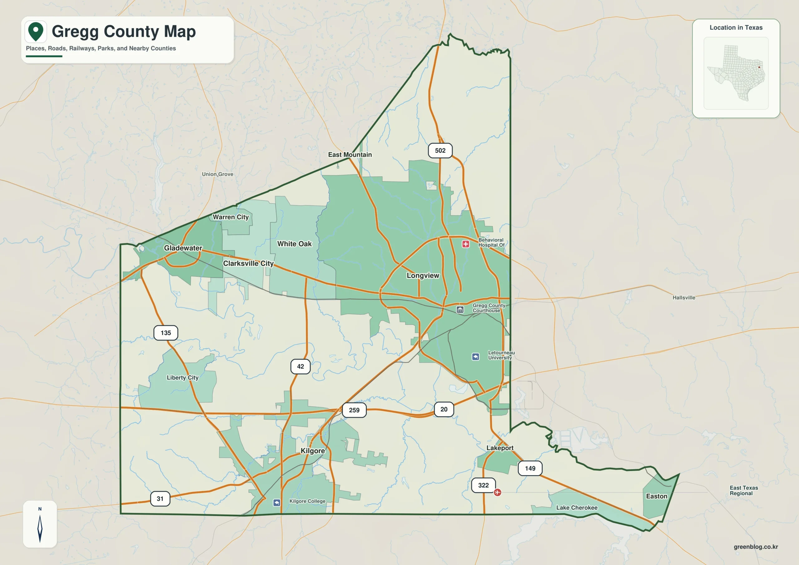
Gregg County offers a unique geographic experience where major cities like Longview and Kilgore sit within a compact area defined by the Sabine River. With an elevation range spanning from approximately 70 to 165 meters, the landscape features distinct ridges and valleys rather than uniform flatness. This guide helps you orient yourself using key landmarks such as LeTourneau University, major road routes like Highway 20, and specific water bodies including Lake Devernia and Moody Creek.
Urban Centers and Road Networks
To begin your exploration, locate Longview in the eastern half of the county, easily identified by the presence of the Gregg County Courthouse and LeTourneau University to its southeast. From this central hub, the urban pattern extends westward through White Oak and Clarksville City toward Gladewater, which sits near the western boundary. Kilgore stands apart as a significant southern center, connected to the Longview area via North-South Route 259. Other notable communities include Warren City and East Mountain in the northwest, Liberty City in the southwest, and Lakeport near the southeastern edge. Understanding these road connections is essential; for instance, Routes 42, 135, and 31 define the western and southern perimeters, while Route 502 runs north of Longview. External landmarks like Union Grove to the west and Hallsville to the east further clarify the county's boundaries, showing that cross-county travel is visible even at this scale.
Waterways and Topographical Relief
The terrain-and-water map reveals a landscape where the Sabine River serves as the primary reference point, crossing from west to east below the county's middle. Once this major artery is identified, smaller tributaries become easier to locate, such as Moody Creek in the northwest, Hawkins Branch near the north-central region, and Grace Creek further east. The area also contains several named lakes, including Lake Harris and Moss Lake near the center, Merrill Lake west of the river corridor, and Williams Lake in the northeast. Elevation data indicates a mean height of roughly 102 meters, with greens marking lower areas that align well with the Sabine River valley. Conversely, yellow, tan, and brown colors highlight progressively higher ground, particularly in the southwest where pronounced ridges appear. The northern extension is characterized by narrow rises divided by green stream valleys, creating a dissected surface rather than a single large upland block.


0 댓글