
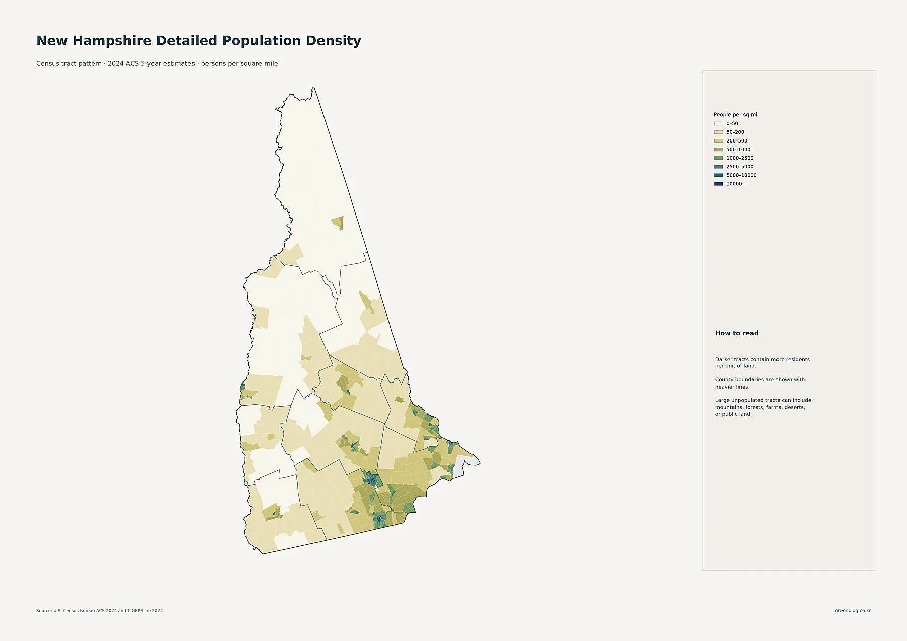
New Hampshire hosts 1,394,868 residents across 8,954 square miles, creating an average density of roughly 156 people per square mile. However, this statewide average masks a stark reality where the southern and southeastern regions are densely populated while the far north remains largely sparse.
Concentrated Southern Hub vs. Sparse Northern Regions
The state's population is heavily concentrated in specific areas, with Manchester and Nashua forming the largest cluster. Additional significant populations exist around Concord, the Seacoast, Dover, Rochester, and smaller centers like Derry, Londonderry, Exeter, Hampton, Portsmouth, Strafford County clusters, and Keene. In contrast, the far north is broadly sparse, with Berlin in Coos County being a localized settlement surrounded by low-density landscapes. Census-tract data reveals that while southern cities form a continuous urban network, the northern regions consist of isolated towns. Manchester leads as the largest census place with 115,643 residents, followed by Nashua with 91,294, while places like Laconia and Lebanon have significantly smaller populations.
County Comparisons: Growth and Density
When analyzing county-level data, Hillsborough County stands out as having both the largest total population of 426,378 residents and the highest average density. Rockingham County follows as the second most populous but is notable for posting the fastest percentage growth during the 2010s. Conversely, Coos County recorded the largest population decline in that same decade. The five available maps provide distinct insights: tract maps show where people are packed into small areas, place maps compare total populations of named cities, and county choropleths average population over land area. Understanding these differences is essential for interpreting New Hampshire's unique demographic landscape.


0 댓글