
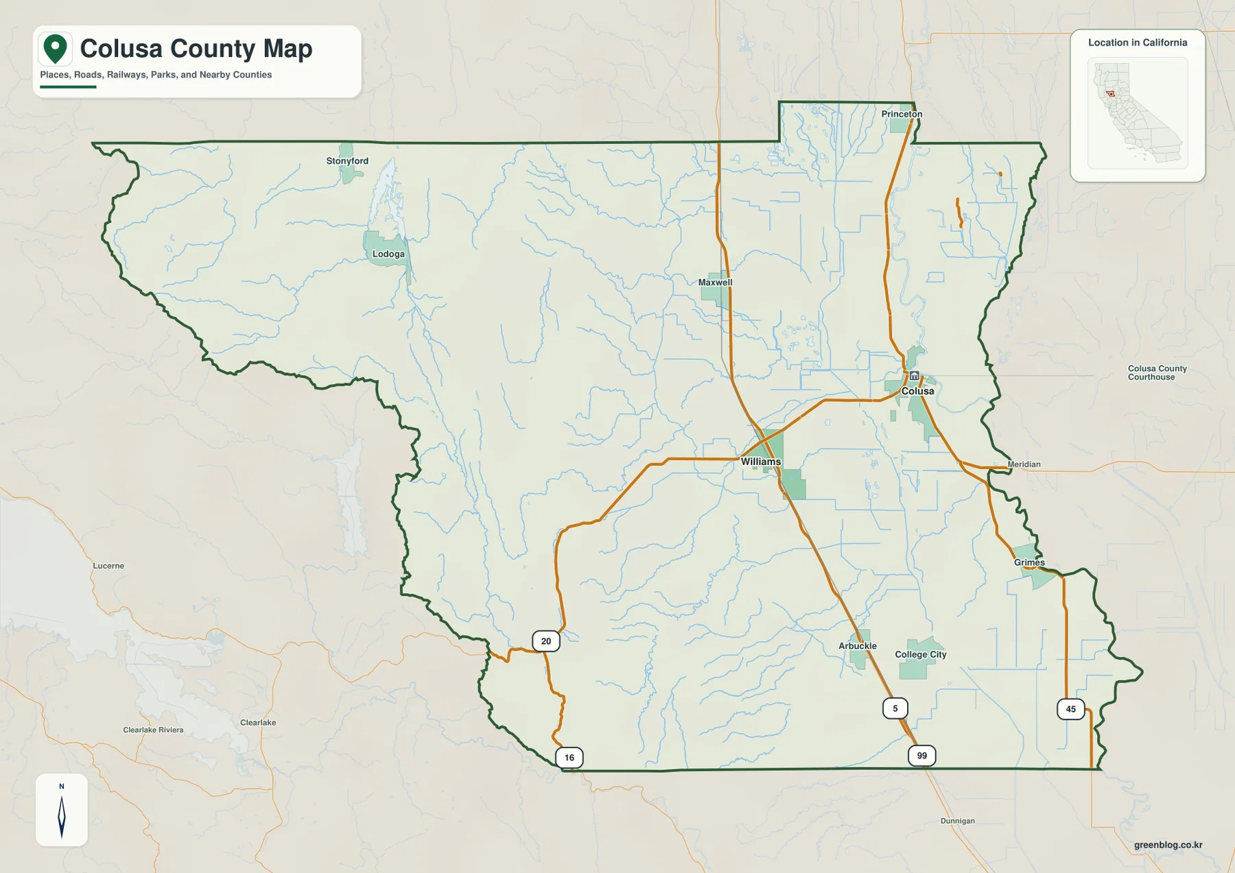
Colusa County in northern California presents a dramatic geographic transition, shifting from the broad Sacramento Valley floor in the east to the rugged Coast Range mountains in the west. This region is defined by two primary transportation corridors and distinct landforms that shape its communities.
Geographic Transition and Major Corridors
The eastern half of the county rests on the expansive Sacramento Valley floor, centered around the City of Colusa near the Sacramento River. Moving westward, the terrain rises sharply into the Coast Range, where communities like Stonyford and Lodoga are nestled in narrow valleys with steep relief. Interstate 5 serves as a critical north-south artery, running through Maxwell and Williams before continuing toward Arbuckle. State Route 20 offers an alternative perspective, crossing the county from west to east and highlighting the contrast between the flat valley floor and the hilly western terrain.
Incorporated Cities and Waterways
Among the various towns in the region, only Colusa and Williams are classified as incorporated cities. Colusa acts as the county seat and is situated close to the Sacramento River, while Williams anchors the I-5 corridor further west. The landscape is dominated by water systems; the Sacramento River and valley drainage control the eastern side, whereas Stone Corral Creek and western tributaries carve through the mountainous west. These distinct environments influence road layouts, with straight lines common in the lowlands and winding paths necessary for the narrow corridors of the mountains.


0 댓글