
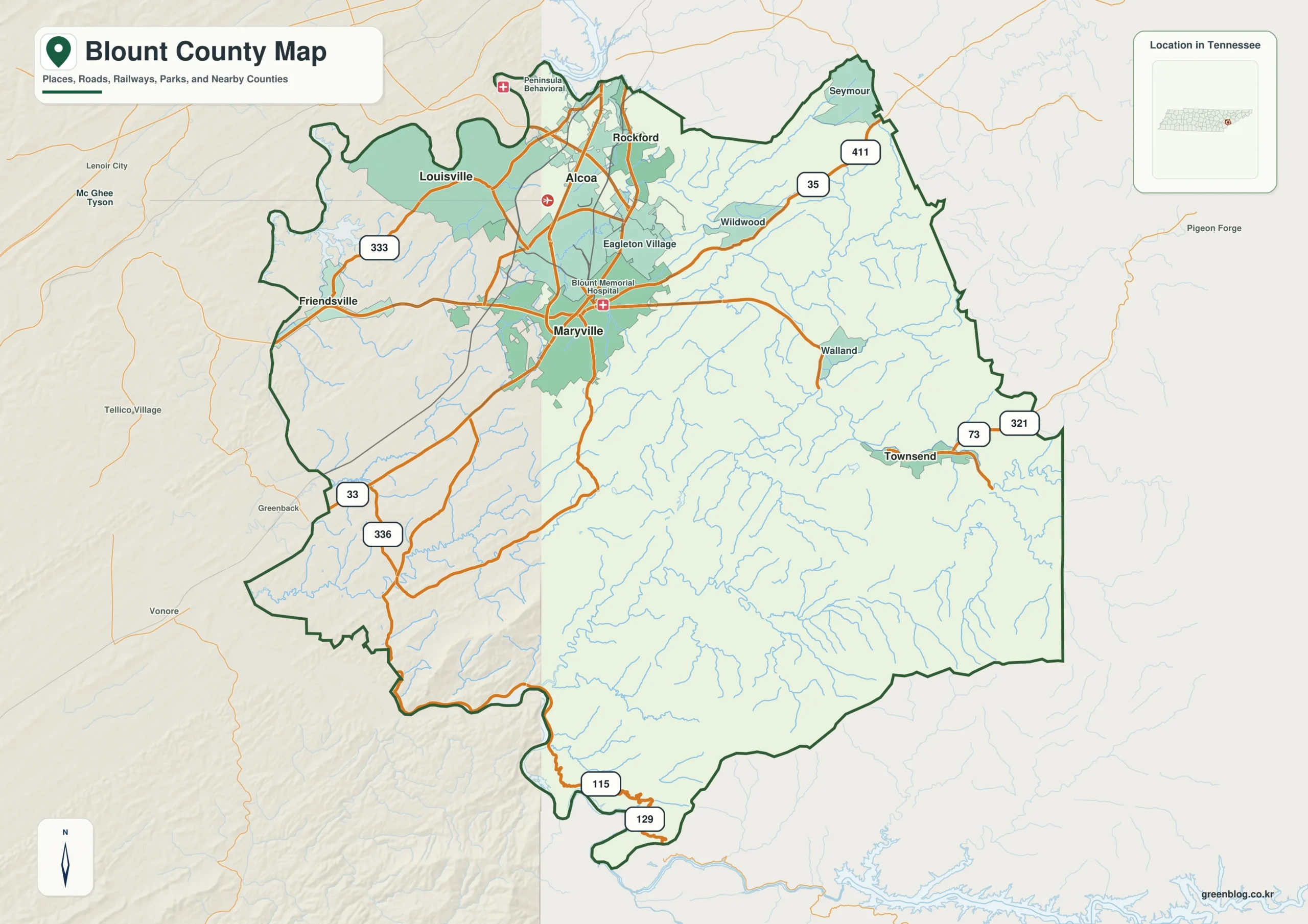
Blount County, Tennessee, transforms dramatically as you move from its urban northwest to its mountainous southeast. This region is defined by a sharp contrast between the dense road networks of Maryville and Alcoa and the steep terrain leading toward Townsend and the Great Smoky Mountains.
Settlement Patterns and Road Networks
The county's geography dictates where people live. The northwest corner, anchored by Maryville and Alcoa, forms a robust transportation hub with Louisville, Friendsville, Rockford, Wildwood, and Walland clustered nearby. Here, roads like US 321, US 411, and SR 33 create a visible web of connectivity. In contrast, Townsend sits isolated to the east near the mountain front, connected primarily by Little River rather than dense highways. The general map reveals that named communities and road density fade significantly as you approach the southeastern edge, where Seymour lies just beyond the boundary and Greenback and Lenoir City sit west of the county.
Elevation and Water Systems
Understanding Blount County requires viewing elevation alongside water flow. The terrain rises from approximately 206 meters in the lower northwest valleys to a dramatic 1,675 meters near the Smokies. This ascent is mirrored by Little River, which originates in the mountain interior and flows toward lower waters. While the city map isolates six major communities for quick comparison, it should not be mistaken for a live population dashboard; current census data remains necessary for precise demographics. Together, these maps illustrate how the landscape shifts from broad, settled terrain to narrow ridges and high country.


0 댓글