
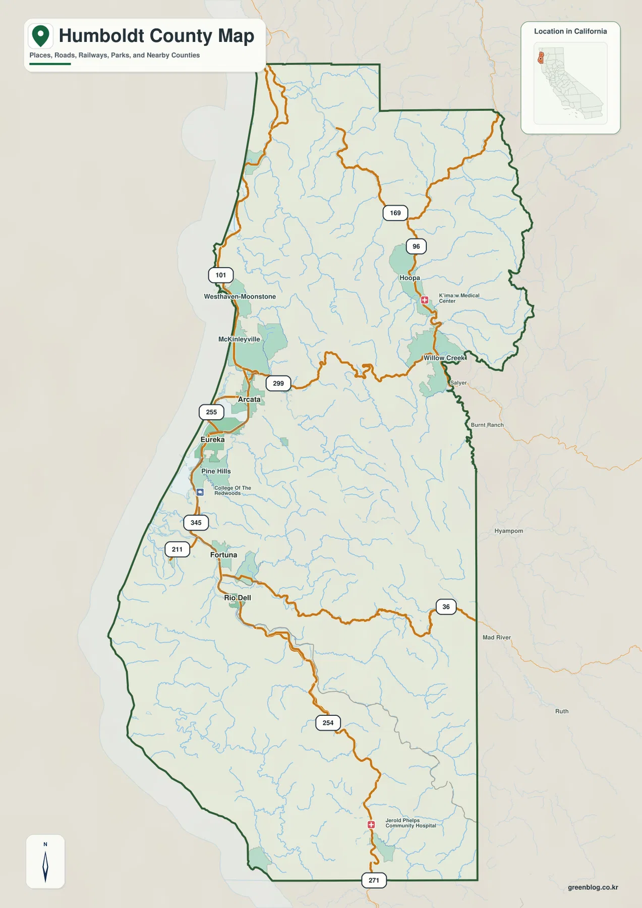
Humboldt County spans California's rugged North Coast, blending urban hubs along Humboldt Bay with deep mountain valleys and ancient redwood forests. Understanding this diverse landscape requires looking beyond city names to the river systems and road networks that define its geography.
Urban Centers and River Corridors
The county's population concentrates heavily around Humboldt Bay, where Eureka serves as the official county seat and sits alongside Arcata to the north. These two cities form a dense settlement pattern supported by schools, medical facilities, and infrastructure along U.S. 101. Extending this coastal network northward is McKinleyville, while south of Eureka lie Pine Hills and the College of the Redwoods before the route continues toward Fortuna. Further inland, the geography shifts dramatically. The Eel River corridor anchors southern communities like Fortuna and Rio Dell, creating a distinct second urban zone separate from the bay area. Meanwhile, Route 299 acts as the primary east-west artery, connecting Arcata to Willow Creek and eventually leading north through Hoopa into the Klamath-Trinity river region. As one moves away from the coast toward these interior mountain drainages, settlement labels become sparse, replaced by detailed terrain features like shaded ridges and winding highways.
Waterways and Natural Landscapes
Rivers serve as the most reliable way to organize Humboldt County's vast geography. The Trinity and Klamath rivers structure the northern and eastern mountain ranges, while the Mad River and Humboldt Bay explain the coastal concentration around the major cities. In the south, the Eel and Van Duzen rivers define the interior landscape, marking the transition into southern redwood country where California State Parks highlights the 32-mile Avenue of the Giants. To the southwest, the remote Mattole and Bear rivers create a unique coastal environment far from the main population centers. The provided reference map captures these relationships without a separate elevation layer, relying instead on visible hill shading to illustrate the terrain's complexity. Whether following U.S. 101 for urban access or exploring Route 254 near the Avenue of the Giants, the interplay between major rivers and road corridors offers the clearest understanding of this complex region.


0 댓글