
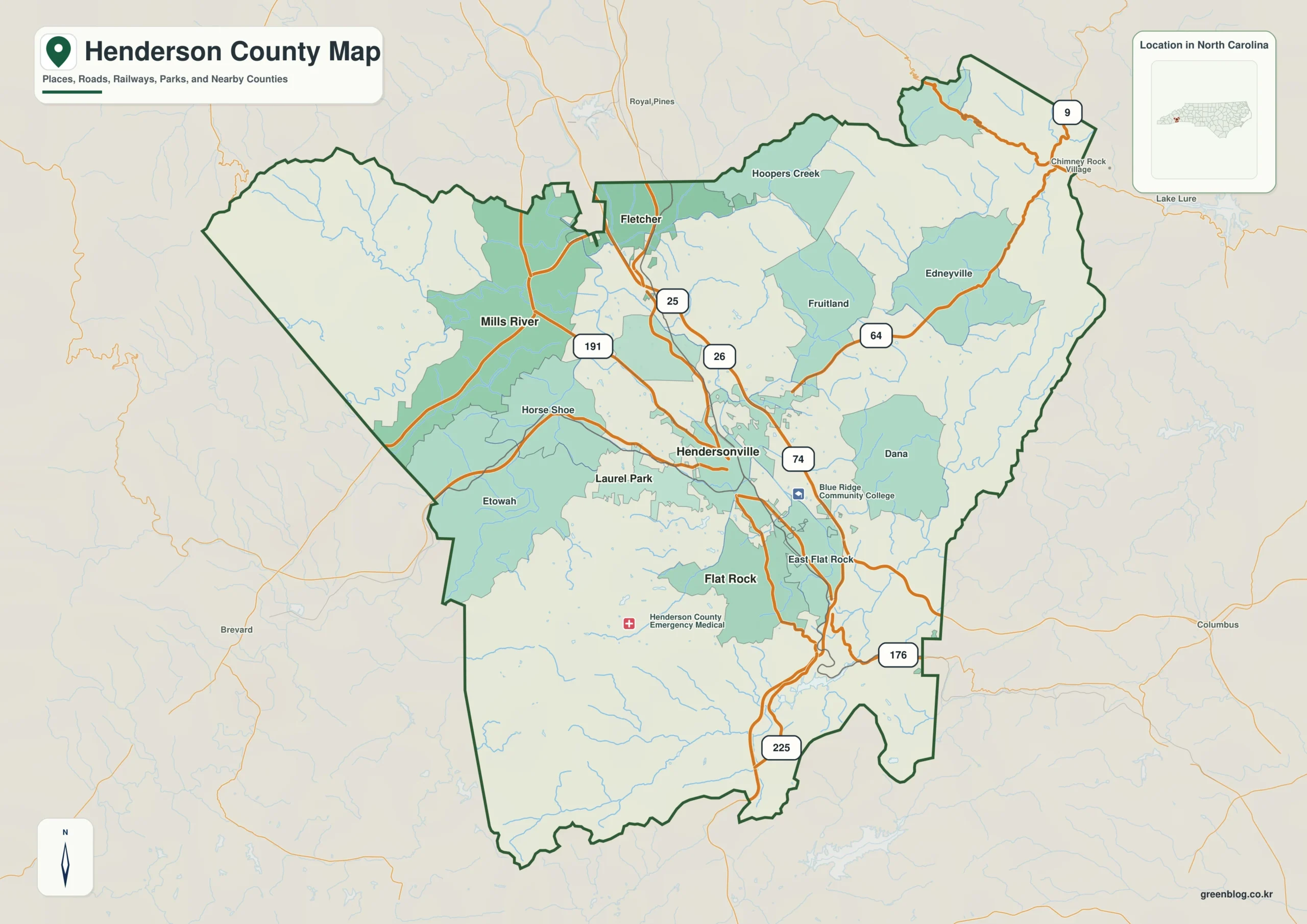
Henderson County in western North Carolina is defined not by a single line but by its rugged terrain, where the central hub of Hendersonville radiates into distinct valleys and ridges. Understanding the county requires viewing it as a landscape of branching streams and mountain passes rather than a simple north-south strip.
The Multi-Directional Road Network and Settlement Pattern
Hendersonville serves as the primary organizing center for the county's road system, intersected by I-26 running north toward Fletcher and US 64 extending east toward Edneyville and Fruitland. While these highways create a clear central hub, the actual communities are distributed across diverse mountain valleys rather than forming a continuous suburban ring. Fletcher anchors the narrow northern end near Buncombe County, connected primarily through the I-26 corridor. In contrast, Mills River sits in a broad western valley linked by NC 191, while Flat Rock marks the transition to the steeper southern terrain. This arrangement reveals that the county's important places pull outward in multiple directions, making the settlement pattern far more complex than a simple circular layout.
Waterways and Terrain Define the Landscape
The physical geography of Henderson County is dominated by its water systems and relief, which dictate where roads and towns can exist. The western half features a cohesive valley system where the French Broad River and Mills River drain steep headwaters, creating broad corridors for settlement. Conversely, the eastern side presents a more dissected terrain with separate streams like the Hungry River and Green River crossing the southern edge. Hendersonville itself sits in a relatively smoother central area surrounded by smaller lakes such as Kanuga Lake and Wolf Lake. Recognizing this difference between the western valley system and the rugged eastern ridges is essential for interpreting how communities like Laurel Park and Edneyville relate to the broader regional geography.


0 댓글