
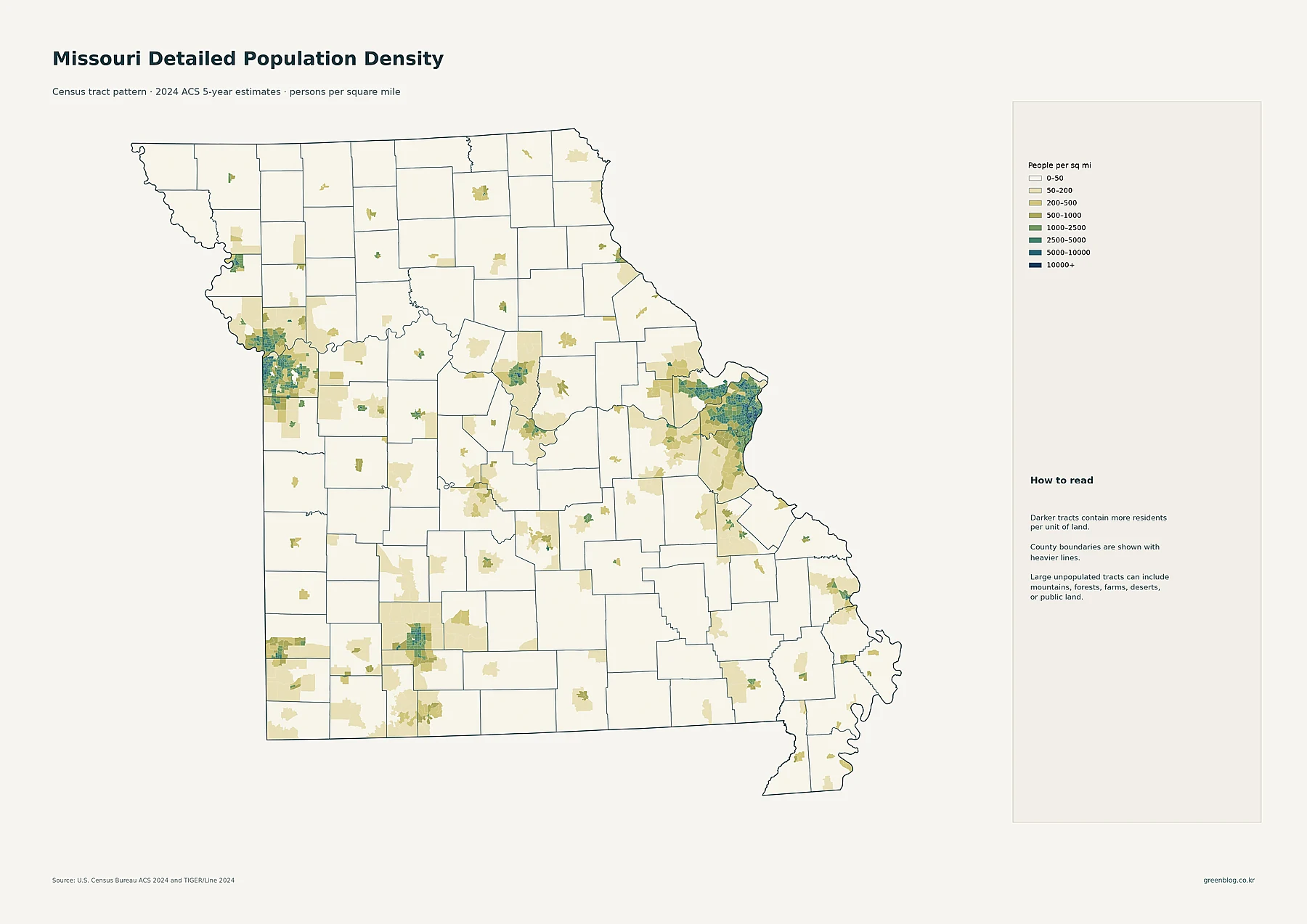
Missouri lacks a single central population core; instead, its 6.19 million residents cluster around two distinct metropolitan anchors on opposite borders. While the statewide average density hovers near 90 people per square mile, this figure obscures the sharp contrast between these urban centers and the vast low-density regions connecting them.
The Dual Core Structure and County Dynamics
The state's population landscape is defined by two major concentrations: the Kansas City region in the west and the St. Louis region in the east. Although St. Louis County holds the largest total population with nearly one million residents, St. Louis city itself boasts the highest average density. This administrative distinction exists because the independent city functions as a county equivalent in Census geography, appearing separately from St. Louis County in official data. Neither metro area led growth between 2010 and 2020; that distinction belongs to Platte County on the Kansas City side, while several southeastern counties recorded sharp declines during the same period.
Regional Clusters Beyond the Metros
Beyond these two primary hubs, Missouri features a network of localized population clusters rather than uniform settlement. The western cluster includes Kansas City as the largest census place with over 510,000 residents, supported by Independence, Lee's Summit, and Blue Springs. The eastern side presents a denser arrangement of suburbs like O'Fallon, St. Charles, and Wentzville surrounding St. Louis city. Other significant centers include Springfield in southwest Missouri, Columbia in the center, and smaller focuses at Joplin, Jefferson City, and Cape Girardeau. Detailed tract maps reveal that high-density areas extend through Jackson and Clay counties westward, and toward St. Charles County eastward, confirming that settlement is concentrated in specific zones rather than spread evenly across the 68,746 square miles of land.


0 댓글