
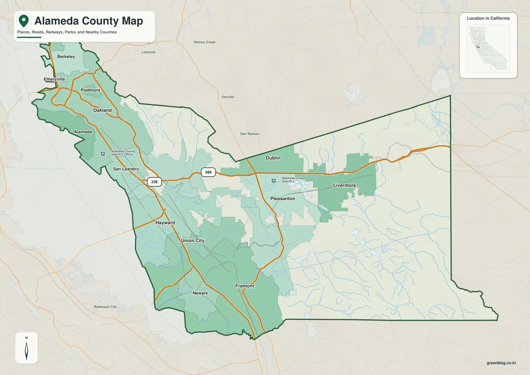
Alameda County presents a dramatic geographical shift, transitioning from a densely populated urban belt along San Francisco Bay to expansive inland valleys and rolling hills. Understanding this west-to-east progression is essential for interpreting the region's landscape and its major settlements.
The Western Urban Belt and Eastern Expansion
The western portion of the county forms a continuous, tightly packed urban corridor stretching from Berkeley and Oakland southward to Fremont. This area includes Alameda, San Leandro, Hayward, Union City, Newark, and Fremont, characterized by dense city labels and a complex road network including State Route 238 and Interstate 580. In stark contrast, moving eastward reveals a separation where the landscape opens into broad hill country before reaching the distinct inland valley system of Dublin, Pleasanton, and Livermore. While Oakland leads the western urban ranking with over 439,000 residents, Livermore stands apart in the east with approximately 85,522 people, surrounded by significant open land rather than the compact development seen on the Bay side.
Map Resources and Data Context
To visualize these differences, a comprehensive map package is available containing a county reference map, a ranked city-distribution graphic, and a terrain-and-water layer. The provided data highlights that Oakland holds the largest population at 439,418, followed by Fremont at 228,295 and Hayward at 158,801. It is important to note that these figures represent values printed on the supplied map rather than current Census estimates. The reference map identifies Oakland as the seat of county government and places it near the western shoreline, while Interstate 580 serves as a key route tracing the transition from the western hills into the eastern developed areas.


0 댓글