
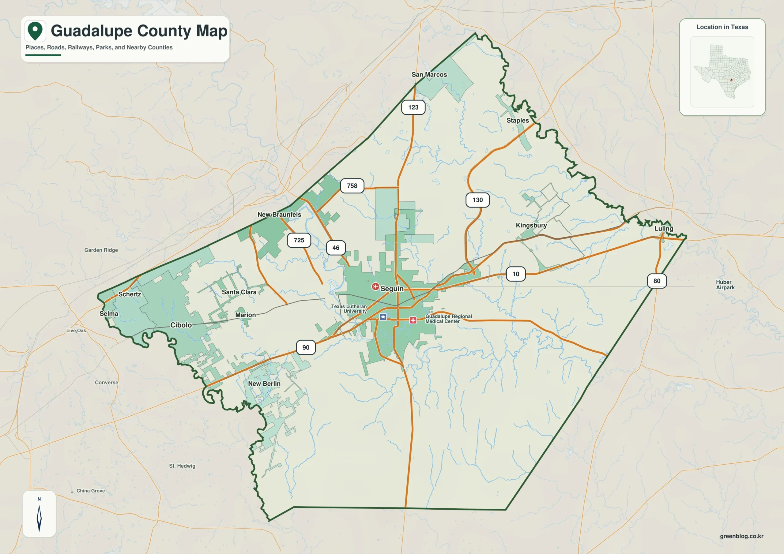
Guadalupe County in south-central Texas presents a distinct geographic contrast between its densely populated western edge and the expansive eastern regions. Understanding this layout requires identifying key landmarks like Seguin as a central hub and recognizing how major rivers and highways define the county's unique structure.
Urban Clusters and Road Networks
The western portion of the county features a tight cluster of settlements including Schertz, Cibolo, Marion, Selma, Santa Clara, and New Berlin, situated near the border with Bexar County. Interstate 10 runs east-west through the center, intersecting with Routes 123, 130, and 46 to create a complex road network anchored by Seguin. While the western cities form a compact group connected to the San Antonio area, the eastern side widens significantly. Here, settlements like Kingsbury and Staples are spaced further apart, and Luling appears near the Route 80 corridor outside the main county boundary. This transition from a dense urban core to an open landscape makes Seguin an ideal starting point for orientation.
Waterways and Elevation Profiles
Natural features play a critical role in defining the county's geography, with the Guadalupe and San Marcos rivers organizing a dense network of smaller creeks and lakes. These water bodies are visible on specialized terrain maps that also illustrate elevation changes ranging from approximately 99 to 290 meters. The highest ground is concentrated in the western areas, while the eastern regions generally sit at lower elevations. Beyond the major cities like New Braunfels and Luling, which lie beyond the northern and eastern map edges respectively, the landscape offers a clear visual distinction between the developed west and the natural east.


0 댓글