
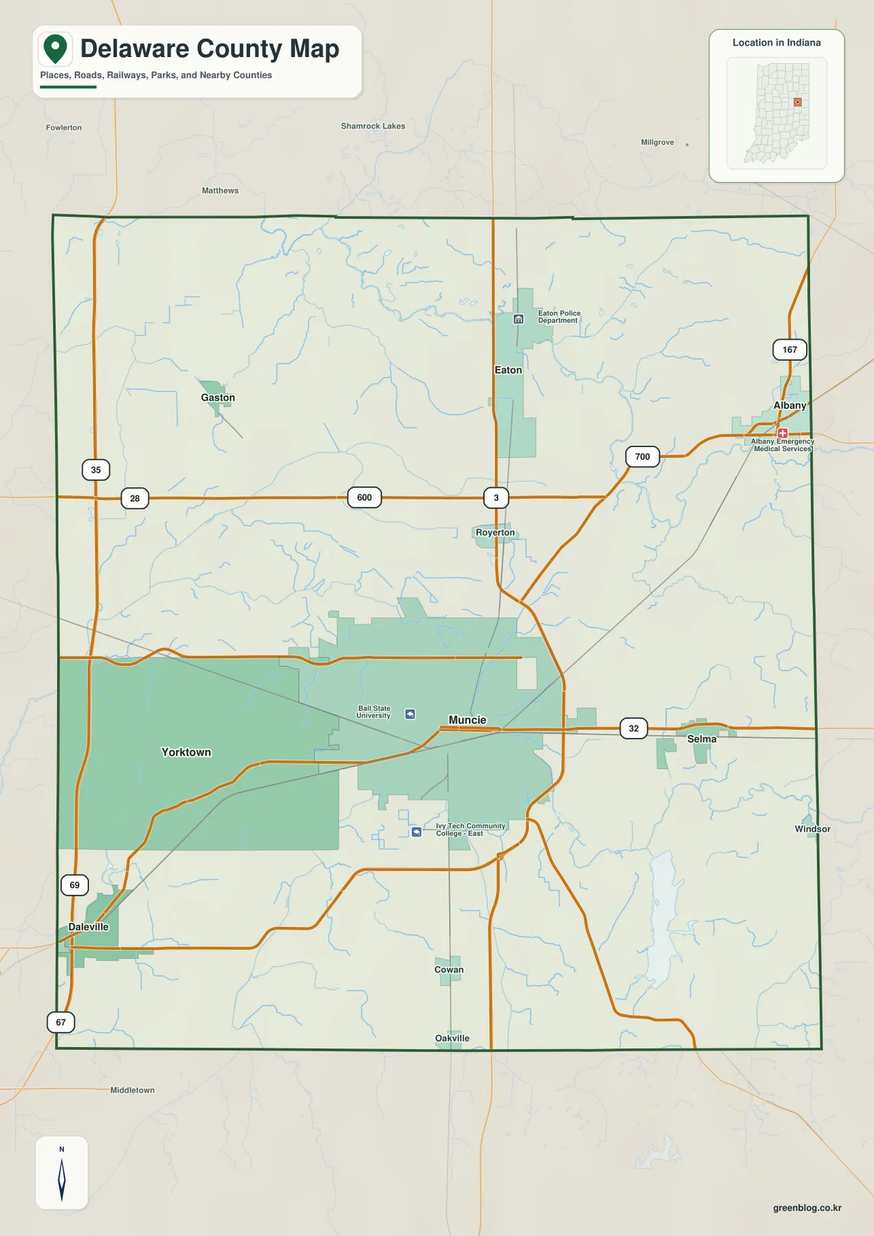
Delaware County in east-central Indiana is best understood by starting with Muncie, the administrative center that organizes the region's primary road network. While the county does not form a single compact urban cluster, its geography is defined by distinct settlements like Yorktown, Selma, Albany, and Daleville, all connected or separated by major State Routes and natural features.
Road Networks and Settlement Patterns
State Road 32 serves as a critical east-west corridor, running west through Yorktown and east toward Selma from Muncie. North of this axis, State Road 3 extends from the Muncie area toward Royerton and Eaton, while Albany stands as a separate northeastern center and Daleville is isolated near the southwestern edge. The layout reveals that towns like Gaston lie to the northwest rather than forming a continuous chain with Yorktown. Ball State University in western Muncie and Ivy Tech Community College southeast of it provide useful orientation points within the built-up area. It is important to note that this map serves for general orientation only; it does not display live traffic, construction closures, lane restrictions, or reliable travel times, nor should the shaded areas be used as legal parcel boundaries.
Water Features and Elevation Contrasts
Beyond roads, water and elevation create a second layer of geography. The Mississinewa River appears near the northern edge, contrasting with the White River and West Fork White River in the southwestern part. Prairie Creek Reservoir forms a prominent body of water in the southeast. Elevation ranges from approximately 230 to 335 meters, with a mean near 287 meters. Broad western and northwestern areas are lower, while the southeast rises into noticeably higher ground. This creates a strong west-to-southeast terrain contrast that is more evident when combining water and elevation data than when viewing the road map alone.


0 댓글