
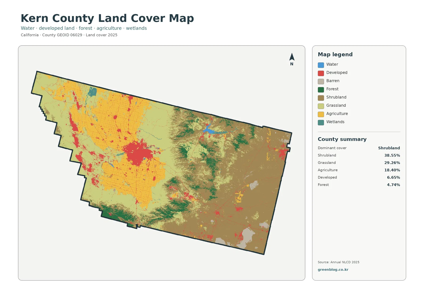
The Kern County California Land Cover Map reveals a complex landscape where dry vegetation, irrigated fields, forests, and urban centers coexist within a single boundary. In the 2025 summary, shrubland dominates at 38.55%, followed by grassland at 29.26% and agriculture at 18.40%. These statistics gain clarity when viewed alongside the map's visual contrast between the agricultural west and the shrub-dominated east.
Regional Patterns and Land Class Definitions
The general land cover map highlights a sharp division across the county. The western region features large yellow agricultural blocks surrounded by light green grassland, while the eastern portion is characterized by brown shrubland with scattered forest patches. Shrubland, covering 38.55%, represents dominant vegetation without identifying specific plant species or ownership status. Grassland accounts for 29.26% and is prevalent around the agricultural belt and central open areas. Agriculture comprises 18.40% of the county, concentrated heavily in the northwestern and central-western sectors rather than being evenly distributed. It is important to note that land cover describes physical surface classes detected by mapping software and should not be confused with parcel ownership, zoning laws, or legal permissions for development.
Urban Concentration and Historical Change
Developed land makes up 6.65% of the county, appearing as a prominent red concentration in the central-western area corresponding to the Bakersfield urban center. Smaller developed patches exist elsewhere, though the map lacks the detail required to trace exact city limits or individual roads. A comparison between 1985 and 2025 data shows a 14.90% class difference across several categories, indicating significant land cover transformation over four decades. The forest and farmland view further clarifies the relationship between the agricultural belt and mountain vegetation, showing that forest covers only 4.74% of the county. While impervious surfaces are concentrated around Bakersfield at 1.90%, this figure is distinct from the broader developed land percentage.


0 댓글