
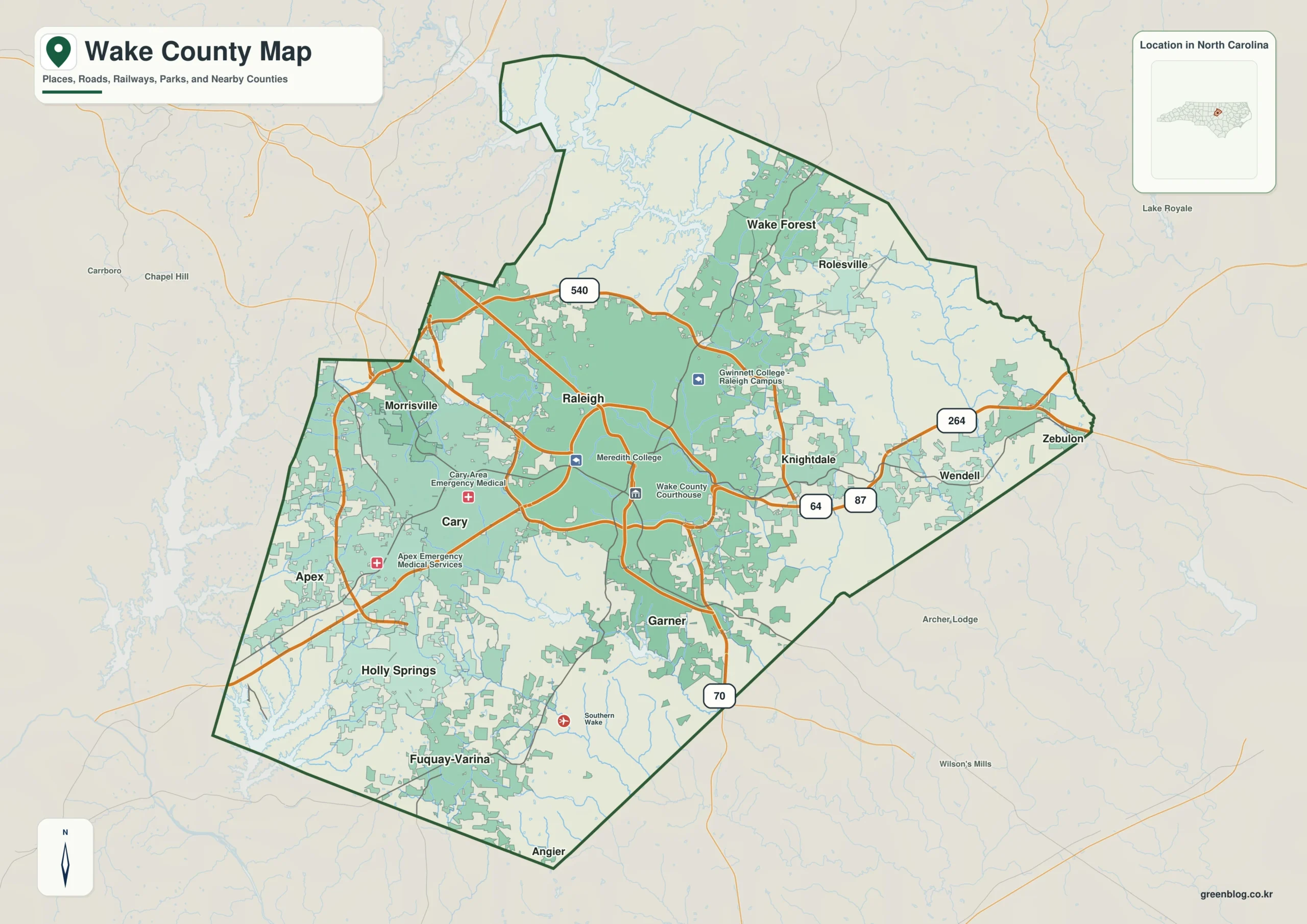
Wake County offers a complex urban landscape where treating Raleigh as the sole center obscures vital directional data. By recognizing distinct growth axes and physical landmarks like Falls Lake and the Neuse River, residents gain a clearer map of this central North Carolina region.
Distinct Urban Corridors and Physical Landmarks
The county's development does not radiate uniformly from Raleigh but instead forms several separate growth axes. To the west, Cary serves as a major counterpoint with Morrisville extending northwest, while Apex continues the corridor southwest toward Holly Springs. The northern direction features Wake Forest near Falls Lake, creating a unique settlement pattern distinct from western suburbs. In the south, Garner acts as the nearest urban reference, followed by a cluster including Holly Springs and Fuquay-Varina. The eastern side is less continuous, anchored by Knightdale near Raleigh but extending outward through Wendell and Zebulon along Routes 64, 264, and 87. Major numbered roads like 540 form an orbital reference around the northern and western sides, yet the urban footprint extends well beyond these boundaries into surrounding counties such as Durham, Franklin, Johnston, Chatham, Harnett, Nash, and Granville.
Population Distribution and Water Systems
Understanding the county requires looking at population rankings alongside geographic location. Raleigh leads with 481,031 residents, followed by Cary at 179,306 and Apex at 70,630. Wake Forest ranks fourth with 52,844, while Holly Springs and Fuquay-Varina follow closely behind. This ranking highlights that Wake Forest is a separate growth direction north of the main western corridor rather than just another suburb. The physical geography further defines these areas; Falls Lake dominates the northern terrain with its irregular shoreline receiving numerous tributaries, making it essential for understanding the northern growth area alongside Wake Forest. The Neuse River runs through the central-eastern county toward the southeast, providing a stable reference east of Raleigh near Knightdale. Other water features like Crabtree Creek, Walnut Creek, Buffalo Creek, and various lakes including Lake Wheeler and Shearon Harris Reservoir help organize the western and southern metro areas into smaller local settings rather than a single uniform surface.


0 댓글