
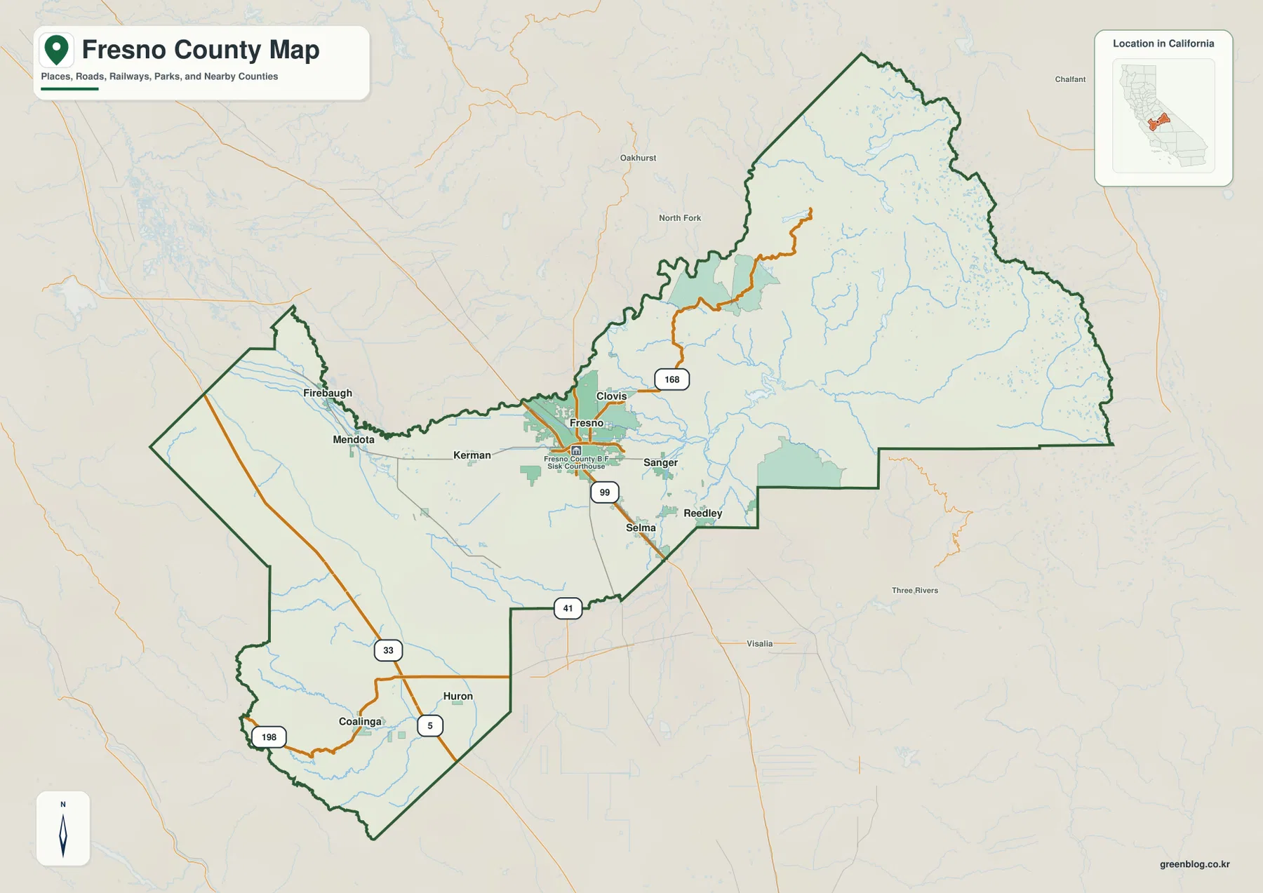
Fresno County presents a dramatic geographic cross-section of central California, stretching from the rugged Sierra Nevada in the east to the flat San Joaquin Valley floor and the Coast Range foothills in the west. This vast region is defined by distinct urban clusters separated by major river systems and varying terrain relief.
Urban Centers and Geographic Divisions
The county's population is heavily concentrated in two main areas: the Fresno-Clovis metropolitan center on the valley floor and a southeastern extension including Sanger, Reedley, and Selma. These cities sit near major highways like 99 and 41, surrounded by smoother terrain compared to the eastern mountains. To the west lie Mendota, Firebaugh, and Coalinga, while Huron occupies the southwest. In stark contrast, the eastern third of the county is dominated by the Sierra Nevada landscape, featuring high reservoirs such as Shaver Lake and Huntington Lake, with few large settlements. The Kings River serves as a critical northern reference point, flowing from Pine Flat Reservoir across the valley floor before reaching agricultural lands east of Fresno.
Data Visualization and Planning Context
Reference materials for this region include a ranked city map highlighting six major municipalities: Fresno (545,970), Clovis (124,725), Sanger (26,699), Reedley (25,609), Selma (24,659), and Coalinga (17,203). While these figures represent specific comparison values printed on the provided graphics, they are not official Census estimates. The reference map further illustrates that all fifteen incorporated cities generally reside on the valley floor, with settlement density dropping off sharply once moving east into the mountainous terrain. Highway 168 connects Clovis toward the Sierra foothills, and Interstate 5 traverses the western zone near Coalinga, underscoring the county's diverse infrastructure needs from flat agricultural land to steep drainage areas.


0 댓글