
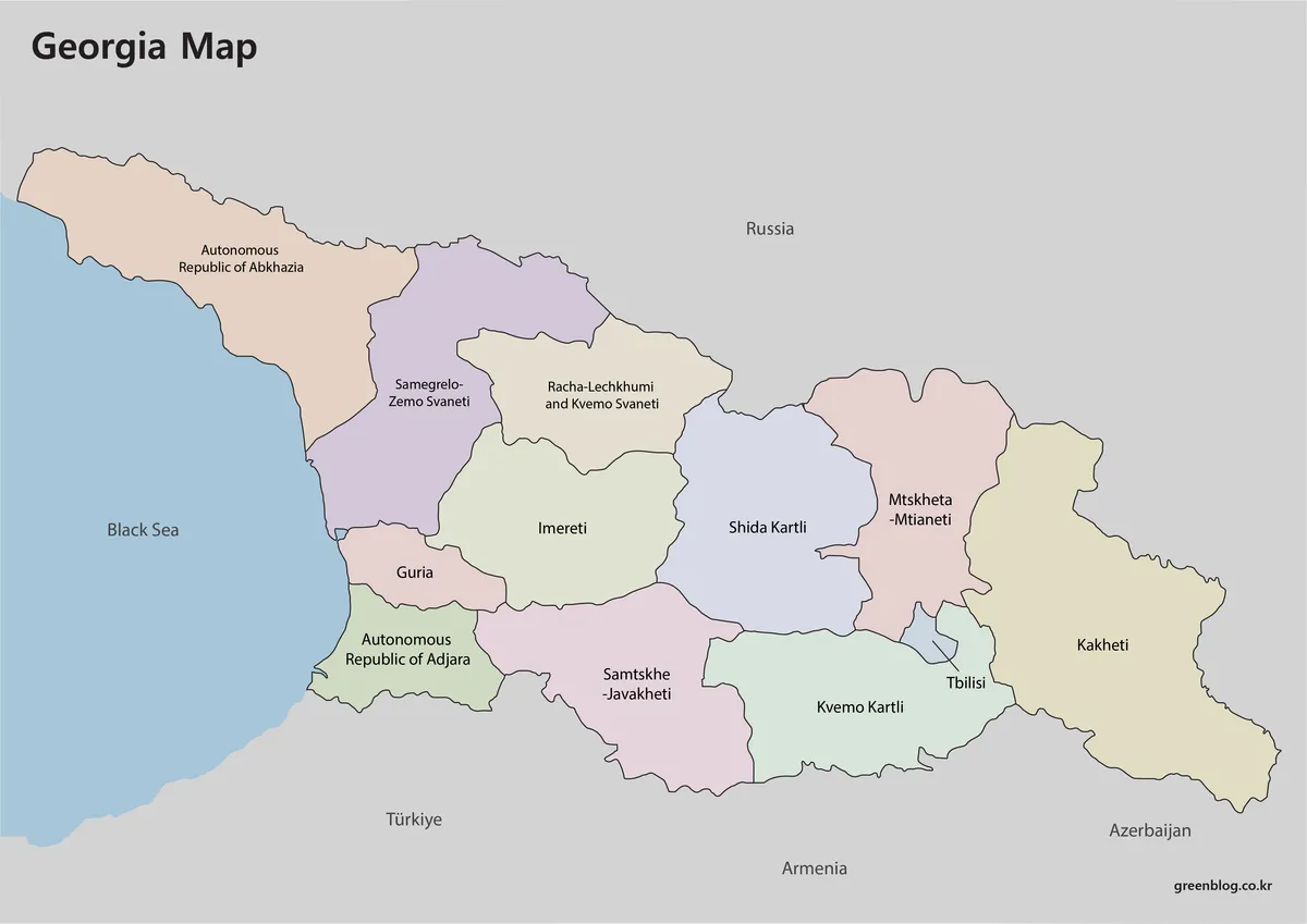
This guide explains how to read administrative maps of Georgia, clarifying its position between the Black Sea and the Caucasus while distinguishing it from U.S. states. The provided visual resources consist of three coordinated files designed for A3 printing, offering labeled color versions, black-and-white outlines, and unlabeled sketches that share identical external borders and internal geometry.
Map Features and Administrative Structure
The maps depict Georgia's nine official regions alongside the Autonomous Republics of Abkhazia and Adjara, with Tbilisi highlighted separately as the capital. Surrounding nations including Russia, Azerbaijan, Armenia, and Türkiye are labeled to provide geographic context. It is important to note that these are administrative charts rather than physical terrain maps; they do not display roads, railways, elevation data, or river systems like the Mtkvari River, though the Greater Caucasus mountain range defines the northern border. The visual collection includes a color map for regional comparison, a black-and-white version for clear boundary tracing, and an outline file suitable for custom labeling exercises.
Naming Conventions and Political Context
The documents utilize specific English spellings such as Adjara, Abkhazia, and Samtske-Javakheti to ensure consistency for general audiences. While some official Georgian statistics may use variations like Ajara or Apkhazeti, the maps adhere to widely accepted forms. The framework reflects Georgia's de jure administrative boundaries, treating Abkhazia as an autonomous republic within the internationally recognized territory without using dashed lines or special textures to indicate disputed control. South Ossetia is notably absent from the regional list and its de facto boundaries are not drawn, remaining instead within the ordinary framework of surrounding regions like Shida Kartli.


0 댓글