
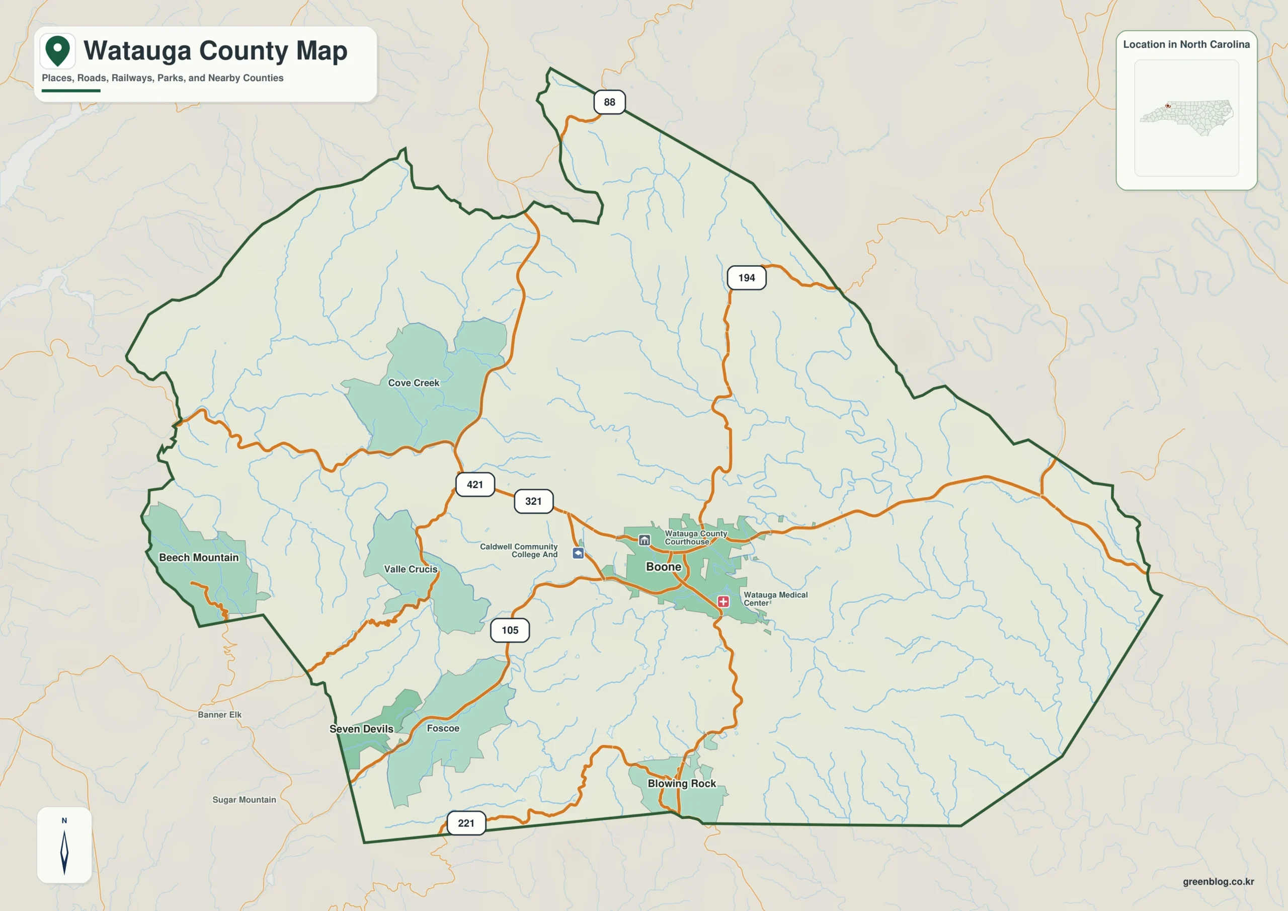
Watauga County defies simple linear mapping because its major settlements sit in distinct valleys rather than forming a continuous urban sprawl. While Boone serves as the primary administrative and university hub, understanding the region requires tracing how roads and streams carve separate corridors through the High Country mountains.
The Valley Divide: Boone, Blowing Rock, and Western Peaks
Boone anchors the county's center with its Watauga County Courthouse and Appalachian State University presence, accessible via Routes 421 and 321. However, it does not radiate outward as a typical suburban core. To the southwest lies Blowing Rock, a distinct tourism destination separated by Route 221, while Valle Crucis sits in its own western valley. Further west, Beech Mountain and Seven Devils occupy the county's mountain edge, creating a complex web where straight-line distances fail to explain travel reality. Meat Camp Creek and Howard Creek flow north of Boone, reinforcing how waterways define these isolated communities rather than connecting them into a single zone.
Waterways as Geographic Frameworks
The terrain map reveals that municipal boundaries are less useful than the river systems for orientation. The South Fork New River curves through the central-eastern mountains, receiving numerous tributaries that divide the high terrain into separate corridors. Cove Creek dominates a long northwestern valley, while Route 194 climbs into sparsely settled northern ridges. Roads frequently bend to follow these lower valleys instead of crossing every ridge directly. This physical geography means that places like Foscoe and Dutch Creek exist within their own hydrological contexts, making the New River headwaters an essential frame for interpreting the county's true layout.


0 댓글