
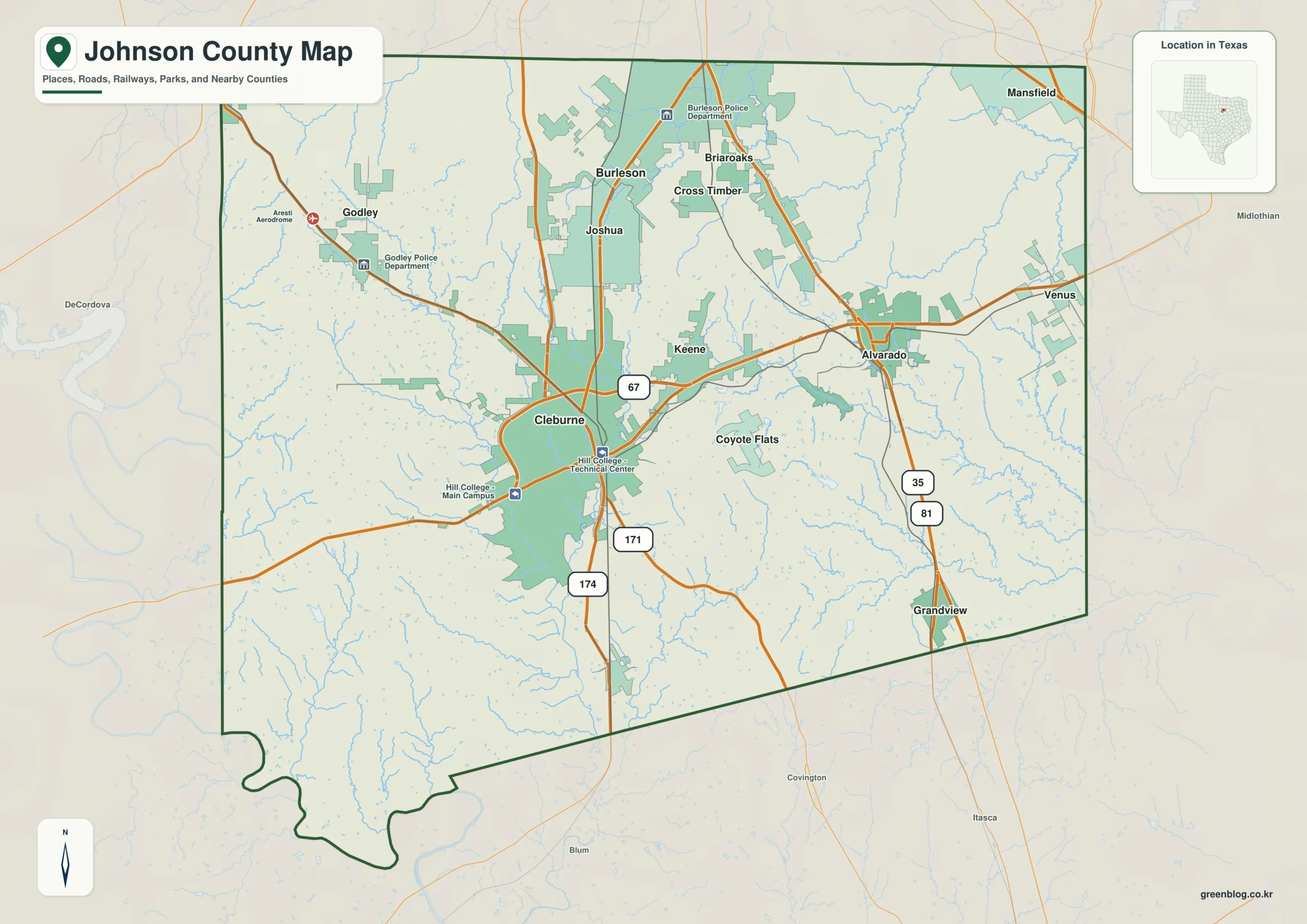
Johnson County, located south of Fort Worth, is best understood by comparing its distinct communities, road networks, water systems, and elevation changes rather than viewing it as a single uniform area.
Community Layout and Transportation Networks
The county's geography centers around Cleburne, the official county seat situated near the middle of the region. While Cleburne serves as the administrative hub, Burleson holds the distinction of being the largest city in the area, occupying the northern section alongside Briaroaks and Cross Timber. Major transportation arteries define the county's connectivity; U.S. Route 67 traverses Cleburne from east to west, intersecting with Highways 171 and 174 nearby. Further north, Interstate 35W and U.S. Route 81 run through Alvarado before continuing toward Burleson. The urban density shifts noticeably across the county, with a cluster of developed communities in the north contrasting against more isolated settlements in the south. Surrounding counties such as Tarrant to the north and Parker to the west provide essential context for the irregular southwestern boundary of Johnson County.
Hydrology and Topographical Variations
Beyond roads and cities, the physical landscape is defined by significant water features and elevation differences. The Nolan River system dominates the western and central portions of the county, while Chambers Creek branches extend across the eastern side. Elevation data reveals a clear gradient where the western side remains higher and more rugged compared to the lower terrain found on the eastern side. This topographical contrast ensures each map type serves a unique purpose, offering specific insights into drainage patterns and landforms that would otherwise be repetitive if presented in isolation.


0 댓글