
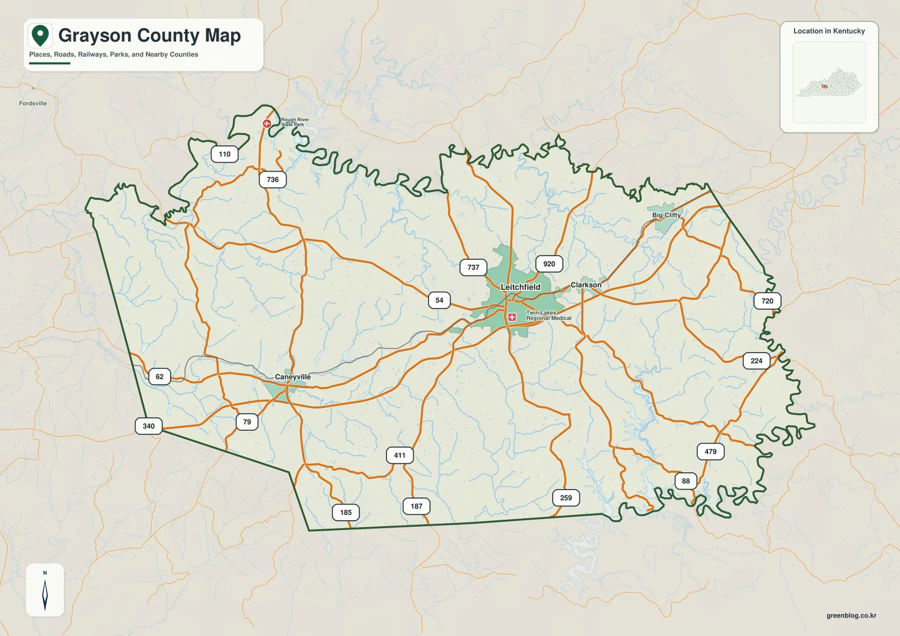
Grayson County in west-central Kentucky is defined by its position between two major reservoirs, Nolin River Lake to the southeast and the Rough River area to the north. With Leitchfield serving as the primary road hub connecting Clarkson to the east and Caneyville to the west, understanding these key locations helps travelers orient themselves through winding roads and creek valleys.
Geographic Layout and Key Towns
Leitchfield anchors the county's road network, situated slightly east of the center with a population of 6,819. Just three miles away lies Clarkson, creating a connected central-eastern region, while Caneyville sits approximately twelve miles west in a more rural setting. The landscape features an elevation range between 127 and 292 meters, separating eastern ridges from lower creek corridors filled with Clifty Creek and Bear Creek. Major routes including 54, 259, 88, 79, 62, and 920 weave through these areas, linking the cities to smaller communities near Big Clifty Dam State Park.
Map Resources for Exploration
To explore the area effectively, users can access four high-resolution map types: a detailed county map, a city-connection map, a terrain-and-water map, and an elevation map. The city-connection map simplifies the view by ranking three principal cities based on straight-line distance, omitting many rural places to focus on urban references. For specific destinations, the detailed county map provides finer place names and road connections, while the elevation map clarifies the transition from higher ridges to lower valley floors near the lake systems.


0 댓글