
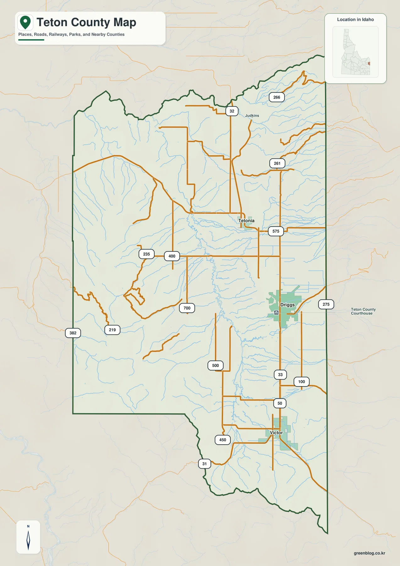
Teton County in eastern Idaho is defined by a broad valley framed by towering mountains, with State Highway 33 serving as the primary north-south corridor connecting Victor, Driggs, and Tetonia. Understanding the relationship between these three towns and the surrounding water systems offers a clearer picture of the region than memorizing individual street names alone.
The Highway Corridor and Central Reference
State Highway 33 acts as the simplest line for orientation, running through Victor in the south, passing Driggs near the county's center, and continuing north to Tetonia. Driggs serves as a vital middle reference point; it hosts the official county courthouse and sits roughly between its southern neighbor, Victor, and its northern neighbor, Tetonia. While the road grid remains regular on the valley floor, roads become steeper and more complex when moving westward toward the mountain fronts. Highway 31 approaches the Victor area from the west, while Highway 32 exits the Tetonia region heading north, marking key transitions in the county's road network.
Direct Distances and Water Systems
Visualizing the layout requires distinguishing between direct distances and driving mileage. On simplified city-connection maps, Driggs is approximately 9 miles from Victor and about 15 miles from Tetonia; however, these figures represent straight-line separations rather than actual road trip lengths. The valley's hydrology is equally distinct, featuring the Teton River alongside a dense network of creeks descending from the surrounding slopes. Packsaddle Lake stands out as a useful western landmark within this landscape. It is important to remember that while elevation colors on available graphics provide comparative context for the low valley floor versus high mountains, they are not survey-grade measurements and should not replace live navigation or official parcel records.


0 댓글