
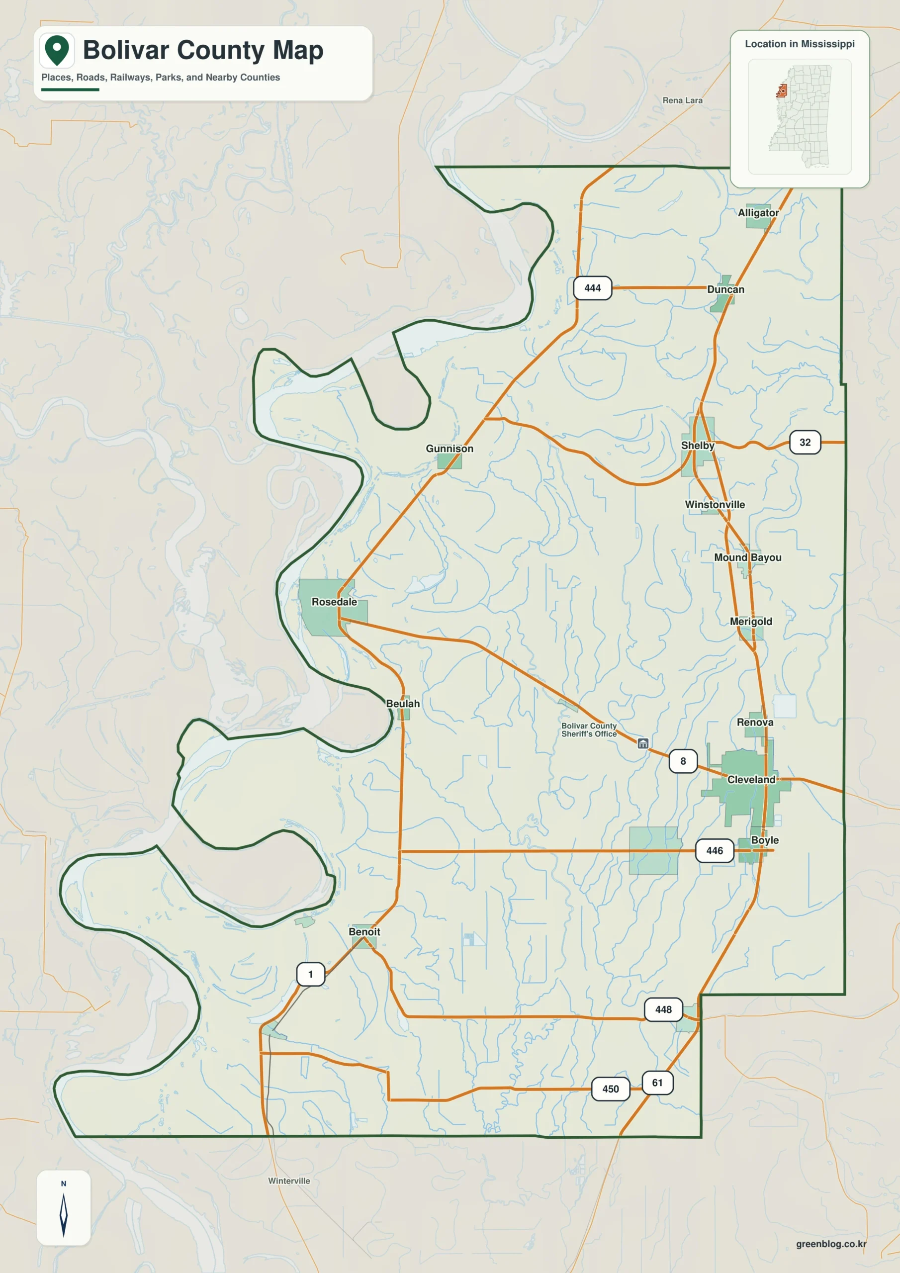
Bolivar County in western Mississippi is defined by its unique geography, stretching far north to south with a western border carved by the winding Mississippi River. Unlike many counties centered on one hub, this region relies on two distinct anchors, Cleveland and Rosedale, to understand its layout.
The Dual Anchor System
Understanding Bolivar County requires looking at it through two primary lenses: the eastern interior seat of Cleveland and the western riverfront location of Rosedale. Cleveland serves as the larger, more populous center with a mapped value of 10,623, situated slightly south of the county's midpoint. In contrast, Rosedale acts as a smaller but vital reference point near a major river bend, holding a value of 1,703. This separation is further illustrated by surrounding towns like Shelby and Mound Bayou to the north, and Shaw to the south, creating a clear east-west divide that no single map marker can fully capture.
Roads, Waterways, and Elevation
The physical landscape of Bolivar County is complex, featuring a dense network of interior streams crossing the Delta plain alongside major routes like US 61 and MS 1. While the western boundary follows deep curves of the Mississippi River, the eastern side remains relatively straighter. The terrain itself offers subtle relief rather than dramatic mountains, with an elevation range spanning only from 33 to 56 meters. These four specific maps—the county overview, city rankings, terrain details, and elevation data—are designed to work together, providing a complete picture of how communities, roads, and water levels interact within this long, narrow Delta region.


0 댓글